

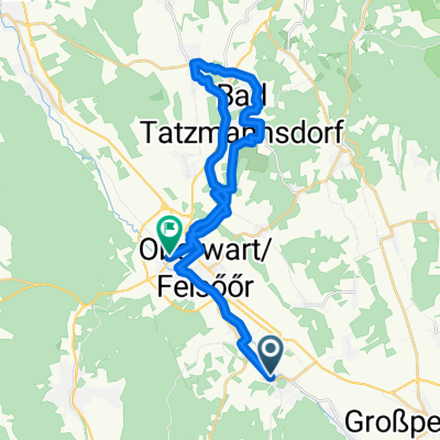
Hauptstraße 18, Rotenturm an der Pinka nach Dorfstraße 1, Eisenberg an der Pinka
A cycling route starting in Rotenturm an der Pinka, Burgenland, Austria.
Overview
About this route
- 1 h 14 min
- Duration
- 19.1 km
- Distance
- 194 m
- Ascent
- 242 m
- Descent
- 15.5 km/h
- Avg. speed
- ---
- Max. altitude
Route quality
Waytypes & surfaces along the route
Waytypes
Quiet road
9.7 km
(51 %)
Road
5.9 km
(31 %)
Surfaces
Paved
10.3 km
(54 %)
Unpaved
0.8 km
(4 %)
Asphalt
10.3 km
(54 %)
Gravel
0.8 km
(4 %)
Undefined
8 km
(42 %)
Continue with Bikemap
Use, edit, or download this cycling route
You would like to ride Hauptstraße 18, Rotenturm an der Pinka nach Dorfstraße 1, Eisenberg an der Pinka or customize it for your own trip? Here is what you can do with this Bikemap route:
Free features
- Save this route as favorite or in collections
- Copy & plan your own version of this route
- Sync your route with Garmin or Wahoo
Premium features
Free trial for 3 days, or one-time payment. More about Bikemap Premium.
- Navigate this route on iOS & Android
- Export a GPX / KML file of this route
- Create your custom printout (try it for free)
- Download this route for offline navigation
Discover more Premium features.
Get Bikemap PremiumFrom our community
Other popular routes starting in Rotenturm an der Pinka
 Granitz 2, Eisenzicken nach Willersdorfer Straße 39, Oberschützen
- Distance
- 51.5 km
- Ascent
- 598 m
- Descent
- 507 m
- Location
- Rotenturm an der Pinka, Burgenland, Austria
 Test
Test- Distance
- 15.7 km
- Ascent
- 125 m
- Descent
- 126 m
- Location
- Rotenturm an der Pinka, Burgenland, Austria
 Unterwart-Hagensdorf neu
- Distance
- 64.2 km
- Ascent
- 629 m
- Descent
- 720 m
- Location
- Rotenturm an der Pinka, Burgenland, Austria
 Granitz, Unterwart nach Markt Neuhodis 40, Markt Neuhodis
- Distance
- 18.4 km
- Ascent
- 771 m
- Descent
- 740 m
- Location
- Rotenturm an der Pinka, Burgenland, Austria
 Rotenturm Bad Tatmannsdorf Oberschützen Oberwart
- Distance
- 27.8 km
- Ascent
- 304 m
- Descent
- 283 m
- Location
- Rotenturm an der Pinka, Burgenland, Austria
 Hauptstraße 18, Rotenturm an der Pinka nach Dorfstraße 1, Eisenberg an der Pinka
- Distance
- 19.1 km
- Ascent
- 194 m
- Descent
- 242 m
- Location
- Rotenturm an der Pinka, Burgenland, Austria
 2022 Csarterberg Runde
- Distance
- 64.9 km
- Ascent
- 732 m
- Descent
- 730 m
- Location
- Rotenturm an der Pinka, Burgenland, Austria
 Schlaining
- Distance
- 31.9 km
- Ascent
- 302 m
- Descent
- 304 m
- Location
- Rotenturm an der Pinka, Burgenland, Austria
Open it in the app