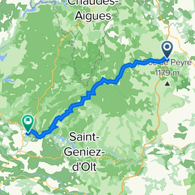
saint-sauveur javols par tiracols - lozère
A cycling route starting in Aumont-Aubrac, Occitanie, France.
Overview
About this route
Total: 32.8km
- -:--
- Duration
- 32.9 km
- Distance
- 451 m
- Ascent
- 451 m
- Descent
- ---
- Avg. speed
- ---
- Max. altitude
Route quality
Waytypes & surfaces along the route
Waytypes
Quiet road
18.2 km
(55 %)
Road
10.1 km
(31 %)
Surfaces
Paved
2 km
(6 %)
Unpaved
3.3 km
(10 %)
Gravel
3.2 km
(10 %)
Asphalt
1.7 km
(5 %)
Continue with Bikemap
Use, edit, or download this cycling route
You would like to ride saint-sauveur javols par tiracols - lozère or customize it for your own trip? Here is what you can do with this Bikemap route:
Free features
- Save this route as favorite or in collections
- Copy & plan your own version of this route
- Sync your route with Garmin or Wahoo
Premium features
Free trial for 3 days, or one-time payment. More about Bikemap Premium.
- Navigate this route on iOS & Android
- Export a GPX / KML file of this route
- Create your custom printout (try it for free)
- Download this route for offline navigation
Discover more Premium features.
Get Bikemap PremiumFrom our community
Other popular routes starting in Aumont-Aubrac
- day 7
- Distance
- 133.5 km
- Ascent
- 1,331 m
- Descent
- 1,966 m
- Location
- Aumont-Aubrac, Occitanie, France
- Santiago routier J02 Aumont Aubrac - Conques
- Distance
- 112.5 km
- Ascent
- 1,273 m
- Descent
- 1,966 m
- Location
- Aumont-Aubrac, Occitanie, France
- Day 3 - Way of St. James - Le Puy to SJPP
- Distance
- 68.8 km
- Ascent
- 474 m
- Descent
- 1,199 m
- Location
- Aumont-Aubrac, Occitanie, France
- saint-sauveur javols par tiracols - lozère
- Distance
- 32.9 km
- Ascent
- 451 m
- Descent
- 451 m
- Location
- Aumont-Aubrac, Occitanie, France
- 113 jacob Aumont Aubrac-Entraygues sur Truyere
- Distance
- 94.9 km
- Ascent
- 717 m
- Descent
- 1,530 m
- Location
- Aumont-Aubrac, Occitanie, France
- De 3 Avenue du Gévaudan, Aumont-Aubrac à Avenue de l'Ancienne Poste, Nasbinals
- Distance
- 22.9 km
- Ascent
- 295 m
- Descent
- 167 m
- Location
- Aumont-Aubrac, Occitanie, France
- championnat regional ffclr 2015
- Distance
- 10.2 km
- Ascent
- 128 m
- Descent
- 128 m
- Location
- Aumont-Aubrac, Occitanie, France
- Itinéraire modéré en Aumont-Aubrac
- Distance
- 20.6 km
- Ascent
- 379 m
- Descent
- 334 m
- Location
- Aumont-Aubrac, Occitanie, France
Open it in the app