

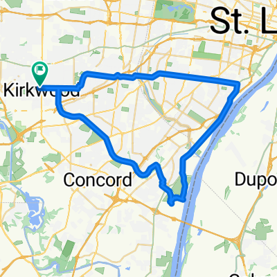
Virtual Ragbrai Day 4 Wednesday
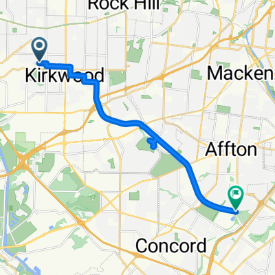
A cycling route starting in Kirkwood, Missouri, United States.
Overview
About this route
Prestemon home to Chain of Rocks Bridge
- -:--
- Duration
- 52.1 km
- Distance
- 171 m
- Ascent
- 241 m
- Descent
- ---
- Avg. speed
- ---
- Max. altitude
Route quality
Waytypes & surfaces along the route
Waytypes
Cycleway
17.2 km
(33 %)
Quiet road
14.1 km
(27 %)
Surfaces
Paved
10.4 km
(20 %)
Asphalt
7.3 km
(14 %)
Paved (undefined)
3.1 km
(6 %)
Undefined
41.7 km
(80 %)
Continue with Bikemap
Use, edit, or download this cycling route
You would like to ride Virtual Ragbrai Day 4 Wednesday or customize it for your own trip? Here is what you can do with this Bikemap route:
Free features
- Save this route as favorite or in collections
- Copy & plan your own version of this route
- Sync your route with Garmin or Wahoo
Premium features
Free trial for 3 days, or one-time payment. More about Bikemap Premium.
- Navigate this route on iOS & Android
- Export a GPX / KML file of this route
- Create your custom printout (try it for free)
- Download this route for offline navigation
Discover more Premium features.
Get Bikemap PremiumFrom our community
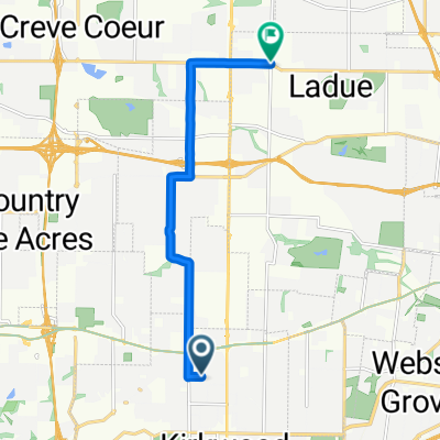
Other popular routes starting in Kirkwood
 12301–12399 Old Big Bend Rd, Kirkwood to 841 Culloden Rd, Kirkwood
- Distance
- 3.1 km
- Ascent
- 32 m
- Descent
- 36 m
- Location
- Kirkwood, Missouri, United States
 ride to work
- Distance
- 21.3 km
- Ascent
- 140 m
- Descent
- 177 m
- Location
- Kirkwood, Missouri, United States
 Clemens Ave, Kirkwood to Grant's Trail, Green Park
- Distance
- 13.8 km
- Ascent
- 82 m
- Descent
- 140 m
- Location
- Kirkwood, Missouri, United States
 Kirkwood-Downtown-JB-Kirkwood
- Distance
- 47.2 km
- Ascent
- 232 m
- Descent
- 234 m
- Location
- Kirkwood, Missouri, United States
 slch
slch- Distance
- 9.5 km
- Ascent
- 99 m
- Descent
- 112 m
- Location
- Kirkwood, Missouri, United States
 Jul 4, 2014, 6:47 PM
- Distance
- 7.2 km
- Ascent
- 49 m
- Descent
- 52 m
- Location
- Kirkwood, Missouri, United States
 140 S Kirkwood Rd, Kirkwood to Grant's Trail, Saint Louis
- Distance
- 8.8 km
- Ascent
- 23 m
- Descent
- 72 m
- Location
- Kirkwood, Missouri, United States
 1316–1330 West Adams Ave, Kirkwood to 214 Lindeman Rd, Kirkwood
- Distance
- 12.3 km
- Ascent
- 113 m
- Descent
- 117 m
- Location
- Kirkwood, Missouri, United States
Open it in the app