Vuelta
A cycling route starting in Santafé, Andalusia, Spain.
Overview
About this route
- -:--
- Duration
- 2,538.1 km
- Distance
- 8,992 m
- Ascent
- 8,910 m
- Descent
- ---
- Avg. speed
- ---
- Avg. speed
Route highlights
Points of interest along the route
Point of interest after 1.3 km
1 Granada - Cogollos de la Vega ITT
Point of interest after 9.7 km
Granada - Cogollos de la Vega ITT
Point of interest after 29.9 km
2 Iznalloz - Córdoba
Point of interest after 134 km
2 Iznalloz - Córdoba
Point of interest after 230.2 km
3 Córdoba - Abenòjar
Point of interest after 315.6 km
4 Abenòjar - Villarta de San Jua
Point of interest after 359.8 km
5 Madridejos - Valera de Arriba vallon
Point of interest after 474.5 km
5 Madridejos - Valera de Arriba vallon
Point of interest after 501 km
6 Las Valeras - Teruel
Point of interest after 584.1 km
6 Las Valeras - Teruel
Point of interest after 721.4 km
7 Teruel - Vinarós
Point of interest after 813.9 km
8 Tarragona - Lloret de Mar
Point of interest after 969.6 km
8 Tarragona - Lloret de Mar
Point of interest after 980.5 km
9 Lloret de Mar - Alto de Sant Grau ITT
Point of interest after 1,055.1 km
10 La Vall d en Bas - Ordino Arcalís montagne
Point of interest after 1,147.2 km
11 Andorra - E.E. Aramón Cerler montagne
Point of interest after 1,155.1 km
10 La Vall d'en Bas - Ordino Arcalís montagne
Point of interest after 1,237.5 km
11 Andorra - E.E. Aramón Cerler montagne
Point of interest after 1,510.6 km
12 Logroño - Burgos
Point of interest after 1,616.1 km
12 Logroño - Burgos
Point of interest after 1,719.8 km
13 Burgos - Santuario de la Bien Aparecida vallon
Point of interest after 1,748.7 km
14 Nestlé / La Penilla - Lagos de Covadonga montagne
Point of interest after 1,850.3 km
14 Nestlé / La Penilla - Lagos de Covadonga montagne
Point of interest after 1,868.3 km
15 Cangas de Onís - Valgrande Pajares montagne
Point of interest after 1,931.9 km
15 Cangas de Onís - Valgrande Pajares montagne
Point of interest after 2,000.1 km
16 León - Valladolid
Point of interest after 2,114.6 km
16 León - Valladolid
Point of interest after 2,208 km
17 El Espinar - La Granja de San Ildefonso montagne
Point of interest after 2,245.4 km
17 El Espinar - La Granja de San Ildefonso montagne
Point of interest after 2,312.9 km
18 Ávila - Ávila montagne
Point of interest after 2,362.8 km
19 San Martín de Valdeiglesias - Alcobendas
Point of interest after 2,433.9 km
19 San Martín de Valdeiglesias - Alcobendas
Point of interest after 2,477.5 km
20 Guadalajara - Alcalá de Henares TTT
Point of interest after 2,511.4 km
20 Guadalajara - Alcalá de Henares TTT
Continue with Bikemap
Use, edit, or download this cycling route
You would like to ride Vuelta or customize it for your own trip? Here is what you can do with this Bikemap route:
Free features
- Save this route as favorite or in collections
- Copy & plan your own version of this route
- Sync your route with Garmin or Wahoo
Premium features
Free trial for 3 days, or one-time payment. More about Bikemap Premium.
- Navigate this route on iOS & Android
- Export a GPX / KML file of this route
- Create your custom printout (try it for free)
- Download this route for offline navigation
Discover more Premium features.
Get Bikemap PremiumFrom our community
Other popular routes starting in Santafé
- 100 de mttb
- Distance
- 106.3 km
- Ascent
- 1,506 m
- Descent
- 1,508 m
- Location
- Santafé, Andalusia, Spain
- Dehesa de Santa Fe 01/07/08 - GR171
- Distance
- 19.3 km
- Ascent
- 300 m
- Descent
- 298 m
- Location
- Santafé, Andalusia, Spain
- Santa Fe Circuit
- Distance
- 7.4 km
- Ascent
- 31 m
- Descent
- 32 m
- Location
- Santafé, Andalusia, Spain
- Purchil Circuit
- Distance
- 15.5 km
- Ascent
- 771 m
- Descent
- 771 m
- Location
- Santafé, Andalusia, Spain
- Belicena to Santa Fe
- Distance
- 3.5 km
- Ascent
- 8 m
- Descent
- 30 m
- Location
- Santafé, Andalusia, Spain
- santa fe, llano la perdiz
- Distance
- 42.5 km
- Ascent
- 435 m
- Descent
- 434 m
- Location
- Santafé, Andalusia, Spain
- Circuito Santa Fe - Chimeneas - Castillo Tajarja 50km
- Distance
- 52.1 km
- Ascent
- 585 m
- Descent
- 584 m
- Location
- Santafé, Andalusia, Spain
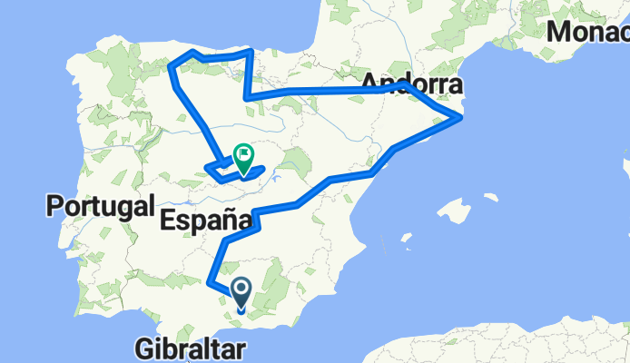
- Belicena to Chauchina
- Distance
- 19.2 km
- Ascent
- 50 m
- Descent
- 51 m
- Location
- Santafé, Andalusia, Spain
Open it in the app