

Kimratshofen-Isny-20200827
A cycling route starting in Altusried, Bavaria, Germany.
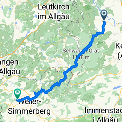
Overview
About this route
ridden on 27.08.2020
- -:--
- Duration
- 62.4 km
- Distance
- 376 m
- Ascent
- 376 m
- Descent
- ---
- Avg. speed
- 874 m
- Max. altitude
Route quality
Waytypes & surfaces along the route
Waytypes
Quiet road
34.3 km
(55 %)
Path
10 km
(16 %)
Surfaces
Paved
43.1 km
(69 %)
Unpaved
3.1 km
(5 %)
Asphalt
36.8 km
(59 %)
Paved (undefined)
6.2 km
(10 %)
Continue with Bikemap
Use, edit, or download this cycling route
You would like to ride Kimratshofen-Isny-20200827 or customize it for your own trip? Here is what you can do with this Bikemap route:
Free features
- Save this route as favorite or in collections
- Copy & plan your own version of this route
- Sync your route with Garmin or Wahoo
Premium features
Free trial for 3 days, or one-time payment. More about Bikemap Premium.
- Navigate this route on iOS & Android
- Export a GPX / KML file of this route
- Create your custom printout (try it for free)
- Download this route for offline navigation
Discover more Premium features.
Get Bikemap PremiumFrom our community
Other popular routes starting in Altusried
 Hauptstraße 20, Altusried nach St2383 9, Lindenberg im Allgäu
- Distance
- 47.3 km
- Ascent
- 1,389 m
- Descent
- 1,349 m
- Location
- Altusried, Bavaria, Germany
 Unterkürnach
- Distance
- 26.4 km
- Ascent
- 588 m
- Descent
- 528 m
- Location
- Altusried, Bavaria, Germany
 AltusriedRunde
- Distance
- 46.3 km
- Ascent
- 530 m
- Descent
- 530 m
- Location
- Altusried, Bavaria, Germany
 UT 03-2023: Altusried - Ulm
- Distance
- 84.5 km
- Ascent
- 383 m
- Descent
- 629 m
- Location
- Altusried, Bavaria, Germany
 Kleine Grönenbach-Runde
- Distance
- 28.1 km
- Ascent
- 372 m
- Descent
- 426 m
- Location
- Altusried, Bavaria, Germany
 Kimratshofen-Isny-20200827
- Distance
- 62.4 km
- Ascent
- 376 m
- Descent
- 376 m
- Location
- Altusried, Bavaria, Germany
 Altusried - Oberschwaben 117 km
- Distance
- 109.2 km
- Ascent
- 513 m
- Descent
- 566 m
- Location
- Altusried, Bavaria, Germany
 MTB Altusried-Leutkirch
- Distance
- 31.5 km
- Ascent
- 360 m
- Descent
- 432 m
- Location
- Altusried, Bavaria, Germany
Open it in the app