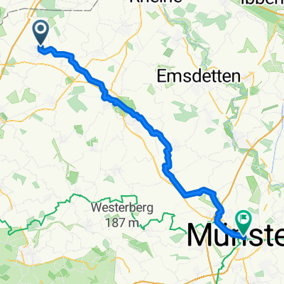
Burning Roads 2011
A cycling route starting in Ochtrup, North Rhine-Westphalia, Germany.
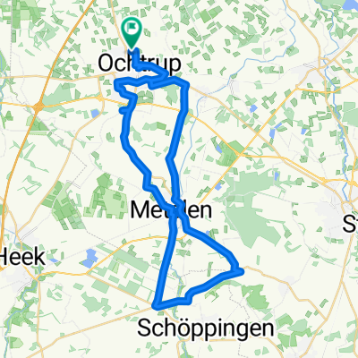
Overview
About this route
Genaue Route des Ochtruper Fahrradmarathons "Burning Roads" 2011.
Der Marathon findet statt am 25.06.2011. Start und Zielort ist Ochtrup.
Die Teilnahme ist mit jedem Radtyp möglich. Eine Durchschnittgeschwindigkeit von 25 km/h muss allerdings gehalten werden können. Es wird in einer großen Gruppe mit Begleitfahrzeugen gefahren. Es gibt keine Zeitmessung und keine Platzierungen.
weitere Infos: www.burningroads.de
- -:--
- Duration
- 369.6 km
- Distance
- 148 m
- Ascent
- 149 m
- Descent
- ---
- Avg. speed
- ---
- Max. altitude
Continue with Bikemap
Use, edit, or download this cycling route
You would like to ride Burning Roads 2011 or customize it for your own trip? Here is what you can do with this Bikemap route:
Free features
- Save this route as favorite or in collections
- Copy & plan your own version of this route
- Split it into stages to create a multi-day tour
- Sync your route with Garmin or Wahoo
Premium features
Free trial for 3 days, or one-time payment. More about Bikemap Premium.
- Navigate this route on iOS & Android
- Export a GPX / KML file of this route
- Create your custom printout (try it for free)
- Download this route for offline navigation
Discover more Premium features.
Get Bikemap PremiumFrom our community
Other popular routes starting in Ochtrup
SCHALKE TOUR 2015- Distance
- 90.9 km
- Ascent
- 148 m
- Descent
- 151 m
- Location
- Ochtrup, North Rhine-Westphalia, Germany
Burning Roads 2011- Distance
- 369.6 km
- Ascent
- 148 m
- Descent
- 149 m
- Location
- Ochtrup, North Rhine-Westphalia, Germany
Von Dom zu Dom- Distance
- 60.3 km
- Ascent
- 156 m
- Descent
- 164 m
- Location
- Ochtrup, North Rhine-Westphalia, Germany
BR_2011_Final- Distance
- 369.1 km
- Ascent
- 146 m
- Descent
- 147 m
- Location
- Ochtrup, North Rhine-Westphalia, Germany
Trainingsrunde- Distance
- 50 km
- Ascent
- 78 m
- Descent
- 89 m
- Location
- Ochtrup, North Rhine-Westphalia, Germany
Wester nach Wester- Distance
- 12.1 km
- Ascent
- 130 m
- Descent
- 173 m
- Location
- Ochtrup, North Rhine-Westphalia, Germany
1.A Kartenclub nach Billerbeck- Distance
- 51.5 km
- Ascent
- 106 m
- Descent
- 117 m
- Location
- Ochtrup, North Rhine-Westphalia, Germany
Freiraum Tag 1 2011 Ochtrup Wietmarschen- Distance
- 47 km
- Ascent
- 58 m
- Descent
- 91 m
- Location
- Ochtrup, North Rhine-Westphalia, Germany
Open it in the app


