

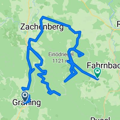
Grafling - Geißriegel - Einödriegel - Geißkopf - Breitenauer Riegel - Dreitannenriegel - Grafling
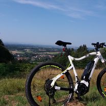
A cycling route starting in Grafling, Bavaria, Germany.
Overview
About this route
Length 28.6 km Points 653 Created 1970-01-01 01:00:00 Max speed 0.0 km/h Area coverage 607.7 ha Min height 409 m Max height 1099 m Elevation gain Distance Uphill 958 m 12242 m Downhill -949 m 10689 m Flat 0 m 5817 m Total 1907 m 28747 m
- -:--
- Duration
- 28.5 km
- Distance
- 965 m
- Ascent
- 956 m
- Descent
- ---
- Avg. speed
- ---
- Max. altitude
Continue with Bikemap
Use, edit, or download this cycling route
You would like to ride Grafling - Geißriegel - Einödriegel - Geißkopf - Breitenauer Riegel - Dreitannenriegel - Grafling or customize it for your own trip? Here is what you can do with this Bikemap route:
Free features
- Save this route as favorite or in collections
- Copy & plan your own version of this route
- Sync your route with Garmin or Wahoo
Premium features
Free trial for 3 days, or one-time payment. More about Bikemap Premium.
- Navigate this route on iOS & Android
- Export a GPX / KML file of this route
- Create your custom printout (try it for free)
- Download this route for offline navigation
Discover more Premium features.
Get Bikemap PremiumFrom our community
Other popular routes starting in Grafling
 Bischofsmais_2b_65km
- Distance
- 65.9 km
- Ascent
- 0 m
- Descent
- 0 m
- Location
- Grafling, Bavaria, Germany
 Susis RR 45 km 520hm
- Distance
- 45 km
- Ascent
- 574 m
- Descent
- 600 m
- Location
- Grafling, Bavaria, Germany
 Grafling - Geißkopf - Grafling
- Distance
- 28.7 km
- Ascent
- 856 m
- Descent
- 852 m
- Location
- Grafling, Bavaria, Germany
 1. rimdberg schneiderried tour
- Distance
- 15.9 km
- Ascent
- 174 m
- Descent
- 256 m
- Location
- Grafling, Bavaria, Germany
 Easy ride in Bischofsmais
- Distance
- 7.6 km
- Ascent
- 984 m
- Descent
- 671 m
- Location
- Grafling, Bavaria, Germany
 Grafling - Bischofsmais
- Distance
- 62.1 km
- Ascent
- 2,052 m
- Descent
- 1,800 m
- Location
- Grafling, Bavaria, Germany
 Schützenstraße 16, Grafling nach Hauptstraße 17, Lalling
- Distance
- 24.4 km
- Ascent
- 475 m
- Descent
- 464 m
- Location
- Grafling, Bavaria, Germany
 Grafling - Geißriegel - Einödriegel - Geißkopf - Breitenauer Riegel - Dreitannenriegel - Grafling
- Distance
- 28.5 km
- Ascent
- 965 m
- Descent
- 956 m
- Location
- Grafling, Bavaria, Germany
Open it in the app