

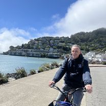
THURSDAY RIDEOUTS
THURSDAY 16 MILE LOOP
A cycling route starting in San Francisco, California, United States.
Overview
About this route
- -:--
- Duration
- 27.1 km
- Distance
- 140 m
- Ascent
- 138 m
- Descent
- ---
- Avg. speed
- ---
- Max. altitude

Part of
THURSDAY RIDEOUTS
2 stages
Route quality
Waytypes & surfaces along the route
Waytypes
Quiet road
6.5 km
(24 %)
Cycleway
4.6 km
(17 %)
Surfaces
Paved
17.6 km
(65 %)
Unpaved
1.6 km
(6 %)
Asphalt
13.6 km
(50 %)
Concrete
2.2 km
(8 %)
Route highlights
Points of interest along the route
Point of interest after 4 km
STOP POINT: FERRY BUILDING
Point of interest after 6.2 km
STOP POINT: PIER 39
Point of interest after 7.2 km
STOP POINT: 1630 STOCKTON STREET for Al Pastor Papi Adult Beverages
Point of interest after 8.5 km
STOP POINT: Inside Union Square Plaza
Point of interest after 8.8 km
STOP POINT: Dragon's Gate
Point of interest after 10.2 km
STOP POINT: The Battery
Point of interest after 11.3 km
STOP POINT: Sales Force Tower Park
Point of interest after 15.9 km
STOP POINT: Rhea's Deli & Market
Point of interest after 17.1 km
STOP POINT: Valencia & Army
Point of interest after 19.5 km
STOP POINT: Army & Evans
Point of interest after 21.7 km
STOP POINT: Evans & Jennings
Point of interest after 23 km
STOP POINT: Heron's Head Park
Continue with Bikemap
Use, edit, or download this cycling route
You would like to ride THURSDAY 16 MILE LOOP or customize it for your own trip? Here is what you can do with this Bikemap route:
Free features
- Save this route as favorite or in collections
- Copy & plan your own version of this route
- Sync your route with Garmin or Wahoo
Premium features
Free trial for 3 days, or one-time payment. More about Bikemap Premium.
- Navigate this route on iOS & Android
- Export a GPX / KML file of this route
- Create your custom printout (try it for free)
- Download this route for offline navigation
Discover more Premium features.
Get Bikemap PremiumFrom our community
Other popular routes starting in San Francisco
 San Francisco Golden Gate Route
- Distance
- 35.2 km
- Ascent
- 495 m
- Descent
- 494 m
- Location
- San Francisco, California, United States
 THURSDAY 16 MILE LOOP
- Distance
- 27.1 km
- Ascent
- 140 m
- Descent
- 138 m
- Location
- San Francisco, California, United States
 Relaxed route in San Francisco
- Distance
- 6.6 km
- Ascent
- 0 m
- Descent
- 6 m
- Location
- San Francisco, California, United States
 Muir Wood über Mill Valley
- Distance
- 38.6 km
- Ascent
- 912 m
- Descent
- 912 m
- Location
- San Francisco, California, United States
 Beach
Beach- Distance
- 19.9 km
- Ascent
- 229 m
- Descent
- 209 m
- Location
- San Francisco, California, United States
 49 Mile Scenic Route
- Distance
- 81.7 km
- Ascent
- 653 m
- Descent
- 653 m
- Location
- San Francisco, California, United States
 Presidio Promenade, San Francisco a Bridgeway, Sausalito
- Distance
- 7.2 km
- Ascent
- 120 m
- Descent
- 145 m
- Location
- San Francisco, California, United States
 Beach St, San Francisco a Beach St, San Francisco
- Distance
- 13.3 km
- Ascent
- 321 m
- Descent
- 310 m
- Location
- San Francisco, California, United States
Open it in the app