

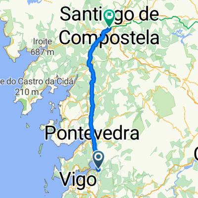
Castillo Soutomaior-Ponte Caldelas
A cycling route starting in Redondela, Galicia, Spain.
Overview
About this route
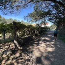
Nice stroll from the castle to the beautiful villa of Ponte Caldela
- -:--
- Duration
- 14.1 km
- Distance
- 386 m
- Ascent
- 249 m
- Descent
- ---
- Avg. speed
- ---
- Max. altitude
Continue with Bikemap
Use, edit, or download this cycling route
You would like to ride Castillo Soutomaior-Ponte Caldelas or customize it for your own trip? Here is what you can do with this Bikemap route:
Free features
- Save this route as favorite or in collections
- Copy & plan your own version of this route
- Sync your route with Garmin or Wahoo
Premium features
Free trial for 3 days, or one-time payment. More about Bikemap Premium.
- Navigate this route on iOS & Android
- Export a GPX / KML file of this route
- Create your custom printout (try it for free)
- Download this route for offline navigation
Discover more Premium features.
Get Bikemap PremiumFrom our community
Other popular routes starting in Redondela
 arcade sanxenxo
- Distance
- 32.5 km
- Ascent
- 277 m
- Descent
- 279 m
- Location
- Redondela, Galicia, Spain
 Ruta moderada en Vigo
- Distance
- 11.8 km
- Ascent
- 201 m
- Descent
- 374 m
- Location
- Redondela, Galicia, Spain
 Camino Português - Day 10 | Arcade to Barro
- Distance
- 25.7 km
- Ascent
- 499 m
- Descent
- 431 m
- Location
- Redondela, Galicia, Spain
 3-Redondela-Santiago
- Distance
- 81.2 km
- Ascent
- 1,382 m
- Descent
- 1,141 m
- Location
- Redondela, Galicia, Spain
 Ruta_!
- Distance
- 27.1 km
- Ascent
- 591 m
- Descent
- 623 m
- Location
- Redondela, Galicia, Spain
 Ruta del agua Redondela
- Distance
- 44.1 km
- Ascent
- 353 m
- Descent
- 346 m
- Location
- Redondela, Galicia, Spain
 Ruta de la Fracha. Peña Corredoira
- Distance
- 35 km
- Ascent
- 908 m
- Descent
- 781 m
- Location
- Redondela, Galicia, Spain
 Castillo Soutomaior-Ponte Caldelas
- Distance
- 14.1 km
- Ascent
- 386 m
- Descent
- 249 m
- Location
- Redondela, Galicia, Spain
Open it in the app