

Grimnitzsee große Runde
A cycling route starting in Joachimsthal, Brandenburg, Germany.
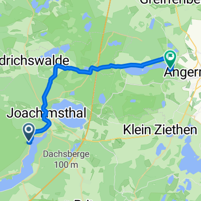
Overview
About this route
From Joachimsthal - Nature observation point Althüttendorf - Carillon & Bat tower Neugrimnitz - Info point Altkünkendorf - Glambeck: Redern Museum in the pigeon tower - Storehouse Parlow (Kranichdorf) - Joach.thal
- -:--
- Duration
- 29.1 km
- Distance
- 170 m
- Ascent
- 171 m
- Descent
- ---
- Avg. speed
- ---
- Max. altitude

Route quality
Waytypes & surfaces along the route
Waytypes
Road
11.1 km
(38 %)
Quiet road
9.6 km
(33 %)
Surfaces
Paved
25.9 km
(89 %)
Asphalt
23.6 km
(81 %)
Concrete
2.3 km
(8 %)
Undefined
3.2 km
(11 %)
Continue with Bikemap
Use, edit, or download this cycling route
You would like to ride Grimnitzsee große Runde or customize it for your own trip? Here is what you can do with this Bikemap route:
Free features
- Save this route as favorite or in collections
- Copy & plan your own version of this route
- Sync your route with Garmin or Wahoo
Premium features
Free trial for 3 days, or one-time payment. More about Bikemap Premium.
- Navigate this route on iOS & Android
- Export a GPX / KML file of this route
- Create your custom printout (try it for free)
- Download this route for offline navigation
Discover more Premium features.
Get Bikemap PremiumFrom our community
Other popular routes starting in Joachimsthal
 Grimnitzsee große Runde
- Distance
- 29.1 km
- Ascent
- 170 m
- Descent
- 171 m
- Location
- Joachimsthal, Brandenburg, Germany
 Barnim Tour
- Distance
- 70.3 km
- Ascent
- 256 m
- Descent
- 256 m
- Location
- Joachimsthal, Brandenburg, Germany
 Grimnitzsee-Runde kurz
- Distance
- 14.2 km
- Ascent
- 65 m
- Descent
- 68 m
- Location
- Joachimsthal, Brandenburg, Germany
 4 I Wolletzsee Angermünde
- Distance
- 25.8 km
- Ascent
- 203 m
- Descent
- 220 m
- Location
- Joachimsthal, Brandenburg, Germany
 Rund um den Werbellinsee
- Distance
- 26.5 km
- Ascent
- 206 m
- Descent
- 206 m
- Location
- Joachimsthal, Brandenburg, Germany
 11. Joachimsthal - Berlin
- Distance
- 75.3 km
- Ascent
- 132 m
- Descent
- 177 m
- Location
- Joachimsthal, Brandenburg, Germany
 tour durch die uckermark
- Distance
- 119.4 km
- Ascent
- 205 m
- Descent
- 204 m
- Location
- Joachimsthal, Brandenburg, Germany
 20170614_175027.gpx
- Distance
- 15.6 km
- Ascent
- 70 m
- Descent
- 67 m
- Location
- Joachimsthal, Brandenburg, Germany
Open it in the app