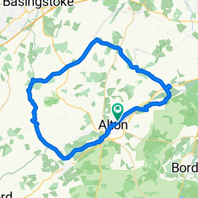
Alton 55km
A cycling route starting in Alton, England, United Kingdom.
Overview
About this route
- -:--
- Duration
- 55.2 km
- Distance
- 332 m
- Ascent
- 324 m
- Descent
- ---
- Avg. speed
- ---
- Max. altitude
Route quality
Waytypes & surfaces along the route
Waytypes
Road
26.5 km
(48 %)
Quiet road
23.2 km
(42 %)
Surfaces
Paved
47.5 km
(86 %)
Asphalt
47.5 km
(86 %)
Undefined
7.7 km
(14 %)
Continue with Bikemap
Use, edit, or download this cycling route
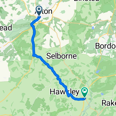
You would like to ride Alton 55km or customize it for your own trip? Here is what you can do with this Bikemap route:
Free features
- Save this route as favorite or in collections
- Copy & plan your own version of this route
- Sync your route with Garmin or Wahoo
Premium features
Free trial for 3 days, or one-time payment. More about Bikemap Premium.
- Navigate this route on iOS & Android
- Export a GPX / KML file of this route
- Create your custom printout (try it for free)
- Download this route for offline navigation
Discover more Premium features.
Get Bikemap PremiumFrom our community
Other popular routes starting in Alton
Alton 55km- Distance
- 55.2 km
- Ascent
- 332 m
- Descent
- 324 m
- Location
- Alton, England, United Kingdom
ride to Four marks and back- Distance
- 11.3 km
- Ascent
- 140 m
- Descent
- 140 m
- Location
- Alton, England, United Kingdom
50km training ride- Distance
- 50.1 km
- Ascent
- 442 m
- Descent
- 444 m
- Location
- Alton, England, United Kingdom
Rake Tour- Distance
- 61.4 km
- Ascent
- 470 m
- Descent
- 491 m
- Location
- Alton, England, United Kingdom
Steady ride in Alton- Distance
- 2.4 km
- Ascent
- 29 m
- Descent
- 26 m
- Location
- Alton, England, United Kingdom
Alton - Winchester via Itchen- Distance
- 29.7 km
- Ascent
- 226 m
- Descent
- 282 m
- Location
- Alton, England, United Kingdom
SU7438-02 ucr- Distance
- 0.5 km
- Ascent
- 0 m
- Descent
- 0 m
- Location
- Alton, England, United Kingdom
Liv and mum- Distance
- 18.8 km
- Ascent
- 144 m
- Descent
- 144 m
- Location
- Alton, England, United Kingdom
Open it in the app

