Route von D33, Pleumeur-Gautier
A cycling route starting in Trédarzec, Brittany Region, France.
Overview
About this route
- 9 min
- Duration
- 1.2 km
- Distance
- 16 m
- Ascent
- 10 m
- Descent
- 8.3 km/h
- Avg. speed
- ---
- Max. altitude
Route quality
Waytypes & surfaces along the route
Waytypes
Road
1.2 km
(100 %)
Continue with Bikemap
Use, edit, or download this cycling route
You would like to ride Route von D33, Pleumeur-Gautier or customize it for your own trip? Here is what you can do with this Bikemap route:
Free features
- Save this route as favorite or in collections
- Copy & plan your own version of this route
- Sync your route with Garmin or Wahoo
Premium features
Free trial for 3 days, or one-time payment. More about Bikemap Premium.
- Navigate this route on iOS & Android
- Export a GPX / KML file of this route
- Create your custom printout (try it for free)
- Download this route for offline navigation
Discover more Premium features.
Get Bikemap PremiumFrom our community
Other popular routes starting in Trédarzec
- De 2 Hent Ar Bizien, Pouldouran à 9–13 Rue Marcellin Berthelot, Tréguier
- Distance
- 5.7 km
- Ascent
- 68 m
- Descent
- 68 m
- Location
- Trédarzec, Brittany Region, France
- 12 Rue de la Chapelle, Trédarzec nach 9 Rue de Poul Guioch, Plestin-les-Grèves
- Distance
- 40.3 km
- Ascent
- 437 m
- Descent
- 421 m
- Location
- Trédarzec, Brittany Region, France
- 2–20 Rue des Gogues, Trédarzec nach 13 Rue Marcellin Berthelot, Tréguier
- Distance
- 2.3 km
- Ascent
- 62 m
- Descent
- 114 m
- Location
- Trédarzec, Brittany Region, France
- Trédarzec (22220), Côtes-d'Armor, Bretagne, France - Saint-Brieuc (22000), Côtes-d'Armor, Bretagne, France
- Distance
- 70.9 km
- Ascent
- 601 m
- Descent
- 574 m
- Location
- Trédarzec, Brittany Region, France
- Recovered Route
- Distance
- 5.3 km
- Ascent
- 79 m
- Descent
- 68 m
- Location
- Trédarzec, Brittany Region, France
- Radtour Plougastel
- Distance
- 118.2 km
- Ascent
- 1,040 m
- Descent
- 990 m
- Location
- Trédarzec, Brittany Region, France
- 3 Traou Meur, Trédarzec nach 12 Rue de la Chapelle, Trédarzec
- Distance
- 39.6 km
- Ascent
- 302 m
- Descent
- 301 m
- Location
- Trédarzec, Brittany Region, France
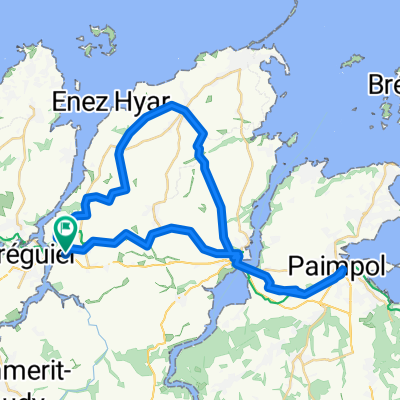
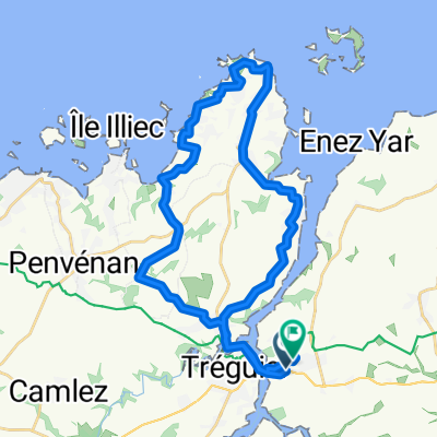
- Route Trestel und Port Blanc
- Distance
- 29 km
- Ascent
- 297 m
- Descent
- 297 m
- Location
- Trédarzec, Brittany Region, France
Open it in the app