

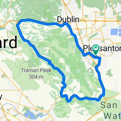
High-speed route in Pleasanton
A cycling route starting in Pleasanton, California, United States.
Overview
About this route
- 3 h 22 min
- Duration
- 68.3 km
- Distance
- 431 m
- Ascent
- 438 m
- Descent
- 20.3 km/h
- Avg. speed
- ---
- Max. altitude

Route quality
Waytypes & surfaces along the route
Waytypes
Road
23.9 km
(35 %)
Quiet road
7.5 km
(11 %)
Surfaces
Paved
23.9 km
(35 %)
Asphalt
19.8 km
(29 %)
Paved (undefined)
3.4 km
(5 %)
Continue with Bikemap
Use, edit, or download this cycling route
You would like to ride High-speed route in Pleasanton or customize it for your own trip? Here is what you can do with this Bikemap route:
Free features
- Save this route as favorite or in collections
- Copy & plan your own version of this route
- Sync your route with Garmin or Wahoo
Premium features
Free trial for 3 days, or one-time payment. More about Bikemap Premium.
- Navigate this route on iOS & Android
- Export a GPX / KML file of this route
- Create your custom printout (try it for free)
- Download this route for offline navigation
Discover more Premium features.
Get Bikemap PremiumFrom our community
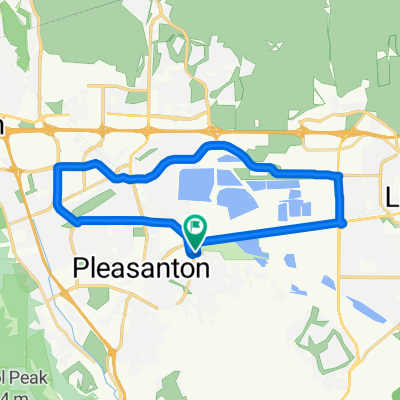
Other popular routes starting in Pleasanton
 Shadow Cliffs-Mines Out and Back
- Distance
- 63.5 km
- Ascent
- 586 m
- Descent
- 579 m
- Location
- Pleasanton, California, United States
 Palomares
- Distance
- 47.9 km
- Ascent
- 494 m
- Descent
- 491 m
- Location
- Pleasanton, California, United States
 Blistering ride in Pleasanton
- Distance
- 63.4 km
- Ascent
- 255 m
- Descent
- 266 m
- Location
- Pleasanton, California, United States
 Pleasanton Ridge Climb
- Distance
- 10.7 km
- Ascent
- 470 m
- Descent
- 232 m
- Location
- Pleasanton, California, United States
 Morgan Territory and Vasco
- Distance
- 114 km
- Ascent
- 950 m
- Descent
- 950 m
- Location
- Pleasanton, California, United States
 High-speed route in Pleasanton
- Distance
- 68.3 km
- Ascent
- 431 m
- Descent
- 438 m
- Location
- Pleasanton, California, United States
 60 Vintage Cir, Pleasanton to 60 Vintage Cir, Pleasanton
- Distance
- 22.7 km
- Ascent
- 67 m
- Descent
- 69 m
- Location
- Pleasanton, California, United States
 5813 Arthur Dr, Pleasanton to 5825 Arthur Dr, Pleasanton
- Distance
- 48.4 km
- Ascent
- 513 m
- Descent
- 522 m
- Location
- Pleasanton, California, United States
Open it in the app