

Col de l'Arpettaz
A cycling route starting in Ugine, Auvergne-Rhône-Alpes, France.
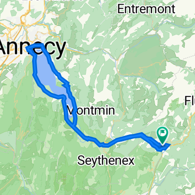
Overview
About this route
sehr schöne, bewaldete Pass-Strecke,
kleine unbefahrene Straße
- -:--
- Duration
- 35.9 km
- Distance
- 1,203 m
- Ascent
- 1,203 m
- Descent
- ---
- Avg. speed
- ---
- Max. altitude
Continue with Bikemap
Use, edit, or download this cycling route
You would like to ride Col de l'Arpettaz or customize it for your own trip? Here is what you can do with this Bikemap route:
Free features
- Save this route as favorite or in collections
- Copy & plan your own version of this route
- Sync your route with Garmin or Wahoo
Premium features
Free trial for 3 days, or one-time payment. More about Bikemap Premium.
- Navigate this route on iOS & Android
- Export a GPX / KML file of this route
- Create your custom printout (try it for free)
- Download this route for offline navigation
Discover more Premium features.
Get Bikemap PremiumFrom our community
Other popular routes starting in Ugine
 Cycling the Alps Signal de Bisanne (1930m)
- Distance
- 24.7 km
- Ascent
- 962 m
- Descent
- 1,231 m
- Location
- Ugine, Auvergne-Rhône-Alpes, France
 Col de l'Arpettaz
- Distance
- 35.9 km
- Ascent
- 1,203 m
- Descent
- 1,203 m
- Location
- Ugine, Auvergne-Rhône-Alpes, France
 Annecy 4; Ugine
- Distance
- 85.2 km
- Ascent
- 2,411 m
- Descent
- 2,396 m
- Location
- Ugine, Auvergne-Rhône-Alpes, France
 Westalpen Etappe 01 - Ugine
- Distance
- 131.8 km
- Ascent
- 2,299 m
- Descent
- 2,290 m
- Location
- Ugine, Auvergne-Rhône-Alpes, France
 test_tout_du_lac_Annecy_1023
- Distance
- 77.9 km
- Ascent
- 613 m
- Descent
- 614 m
- Location
- Ugine, Auvergne-Rhône-Alpes, France
 5 cols from Ugine
- Distance
- 79.5 km
- Ascent
- 1,893 m
- Descent
- 1,893 m
- Location
- Ugine, Auvergne-Rhône-Alpes, France
 Ugine - Aviernoz
- Distance
- 88.4 km
- Ascent
- 2,011 m
- Descent
- 1,651 m
- Location
- Ugine, Auvergne-Rhône-Alpes, France
 Col Aperttaz via Ugine
- Distance
- 16.3 km
- Ascent
- 1,272 m
- Descent
- 114 m
- Location
- Ugine, Auvergne-Rhône-Alpes, France
Open it in the app