

Podjazd na Godulę i Ropiczkę
A cycling route starting in Lučina, Moravskoslezský kraj, Czechia.
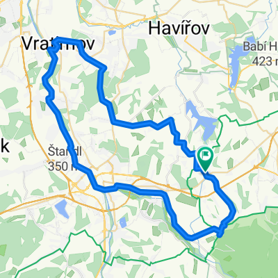
Overview
About this route
- -:--
- Duration
- 6.7 km
- Distance
- 570 m
- Ascent
- 89 m
- Descent
- ---
- Avg. speed
- ---
- Max. altitude

Route quality
Waytypes & surfaces along the route
Waytypes
Access road
4.1 km
(61 %)
Quiet road
1.5 km
(22 %)
Surfaces
Paved
5.2 km
(77 %)
Unpaved
0.1 km
(1 %)
Asphalt
4.1 km
(61 %)
Paved (undefined)
1.1 km
(16 %)
Route highlights
Points of interest along the route

Point of interest after 0 km
Komorni Lhotka 410 m. START

Point of interest after 0.1 km

Point of interest after 0.6 km

Point of interest after 0.8 km

Point of interest after 1.8 km

Point of interest after 2 km

Point of interest after 2.8 km

Point of interest after 3.2 km
Godula hotel Ondrasz 710 m. Meta czasówki na Godulę lub półmetek czasówki na Ropiczkę

Point of interest after 3.8 km

Point of interest after 4.2 km
Sedlo

Point of interest after 5 km
Krivy 743 m.

Point of interest after 5.5 km
Sedlo

Point of interest after 6.2 km

Point of interest after 6.7 km
Ropiczka 900 m. META
Continue with Bikemap
Use, edit, or download this cycling route
You would like to ride Podjazd na Godulę i Ropiczkę or customize it for your own trip? Here is what you can do with this Bikemap route:
Free features
- Save this route as favorite or in collections
- Copy & plan your own version of this route
- Sync your route with Garmin or Wahoo
Premium features
Free trial for 3 days, or one-time payment. More about Bikemap Premium.
- Navigate this route on iOS & Android
- Export a GPX / KML file of this route
- Create your custom printout (try it for free)
- Download this route for offline navigation
Discover more Premium features.
Get Bikemap PremiumFrom our community
Other popular routes starting in Lučina
 picytur2015-01
- Distance
- 53.6 km
- Ascent
- 329 m
- Descent
- 328 m
- Location
- Lučina, Moravskoslezský kraj, Czechia
 Výjezd na Prašivou
- Distance
- 4.9 km
- Ascent
- 354 m
- Descent
- 102 m
- Location
- Lučina, Moravskoslezský kraj, Czechia
 Dookoła Lysej Hory
- Distance
- 95.3 km
- Ascent
- 1,419 m
- Descent
- 1,419 m
- Location
- Lučina, Moravskoslezský kraj, Czechia
 Do konia na pivo
- Distance
- 44.2 km
- Ascent
- 282 m
- Descent
- 282 m
- Location
- Lučina, Moravskoslezský kraj, Czechia
 Žermanice do Žermanice
- Distance
- 34.4 km
- Ascent
- 480 m
- Descent
- 478 m
- Location
- Lučina, Moravskoslezský kraj, Czechia
 Dobratice
- Distance
- 3.4 km
- Ascent
- 105 m
- Descent
- 0 m
- Location
- Lučina, Moravskoslezský kraj, Czechia
 RAJD 2017
- Distance
- 10.2 km
- Ascent
- 119 m
- Descent
- 119 m
- Location
- Lučina, Moravskoslezský kraj, Czechia
 Soběšovice, Soběšovice do Soběšovice, Soběšovice
- Distance
- 30.7 km
- Ascent
- 410 m
- Descent
- 449 m
- Location
- Lučina, Moravskoslezský kraj, Czechia
Open it in the app