Nagoldtalradweg - Urnagold - (Calw) Pforzheim
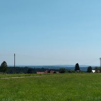
A cycling route starting in Simmersfeld, Baden-Württemberg, Germany.
Overview
About this route
Von der Mündung in die Enz in Pforzheim bis zum Ursprung in Besenfeld fahren Sie entlang der Nagold und genießen die wunderschöne Natur des Nördlichen Schwarzwaldes. /
- -:--
- Duration
- 125.4 km
- Distance
- 2,242 m
- Ascent
- 2,468 m
- Descent
- ---
- Avg. speed
- ---
- Avg. speed
Route quality
Waytypes & surfaces along the route
Waytypes
Track
43.3 km
(35 %)
Quiet road
25.3 km
(20 %)
Surfaces
Paved
92.8 km
(74 %)
Unpaved
5.7 km
(5 %)
Asphalt
84 km
(67 %)
Paved (undefined)
6.5 km
(5 %)
Continue with Bikemap
Use, edit, or download this cycling route
You would like to ride Nagoldtalradweg - Urnagold - (Calw) Pforzheim or customize it for your own trip? Here is what you can do with this Bikemap route:
Free features
- Save this route as favorite or in collections
- Copy & plan your own version of this route
- Sync your route with Garmin or Wahoo
Premium features
Free trial for 3 days, or one-time payment. More about Bikemap Premium.
- Navigate this route on iOS & Android
- Export a GPX / KML file of this route
- Create your custom printout (try it for free)
- Download this route for offline navigation
Discover more Premium features.
Get Bikemap PremiumFrom our community
Other popular routes starting in Simmersfeld
- Leichte Samstag nachmittags Tour
- Distance
- 70.6 km
- Ascent
- 625 m
- Descent
- 625 m
- Location
- Simmersfeld, Baden-Württemberg, Germany
- 2019 Tag2 Besenfeld - Hornisgrinde (Mummelsee)
- Distance
- 60.3 km
- Ascent
- 1,167 m
- Descent
- 1,167 m
- Location
- Simmersfeld, Baden-Württemberg, Germany
- rwgps-ebhausen110
- Distance
- 110.3 km
- Ascent
- 1,595 m
- Descent
- 1,594 m
- Location
- Simmersfeld, Baden-Württemberg, Germany
- simmersfeld56
- Distance
- 56.1 km
- Ascent
- 932 m
- Descent
- 931 m
- Location
- Simmersfeld, Baden-Württemberg, Germany
- Nagold Enz
- Distance
- 99.4 km
- Ascent
- 91 m
- Descent
- 655 m
- Location
- Simmersfeld, Baden-Württemberg, Germany
- Familienradweg Nagoldtal_Import
- Distance
- 83 km
- Ascent
- 1,141 m
- Descent
- 1,662 m
- Location
- Simmersfeld, Baden-Württemberg, Germany
- Besenfeld - Freudenstadt- Wolfach - Mühlenbach (Blackforest 2)
- Distance
- 76.2 km
- Ascent
- 554 m
- Descent
- 1,082 m
- Location
- Simmersfeld, Baden-Württemberg, Germany
- Nagoldtalradweg - Urnagold - (Calw) Pforzheim
- Distance
- 125.4 km
- Ascent
- 2,242 m
- Descent
- 2,468 m
- Location
- Simmersfeld, Baden-Württemberg, Germany
Open it in the app