

Beauregard
A cycling route starting in Lincolnia, Virginia, United States.
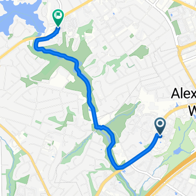
Overview
About this route
- -:--
- Duration
- 7.8 km
- Distance
- 76 m
- Ascent
- 73 m
- Descent
- ---
- Avg. speed
- ---
- Max. altitude
Route quality
Waytypes & surfaces along the route
Waytypes
Busy road
4.2 km
(54 %)
Quiet road
2.6 km
(33 %)
Surfaces
Paved
4.2 km
(54 %)
Asphalt
4.2 km
(54 %)
Undefined
3.6 km
(46 %)
Continue with Bikemap
Use, edit, or download this cycling route
You would like to ride Beauregard or customize it for your own trip? Here is what you can do with this Bikemap route:
Free features
- Save this route as favorite or in collections
- Copy & plan your own version of this route
- Sync your route with Garmin or Wahoo
Premium features
Free trial for 3 days, or one-time payment. More about Bikemap Premium.
- Navigate this route on iOS & Android
- Export a GPX / KML file of this route
- Create your custom printout (try it for free)
- Download this route for offline navigation
Discover more Premium features.
Get Bikemap PremiumFrom our community
Other popular routes starting in Lincolnia
 706 N Howard St, Alexandria to 622 N Howard St, Alexandria
- Distance
- 15.5 km
- Ascent
- 78 m
- Descent
- 78 m
- Location
- Lincolnia, Virginia, United States
 From Alexandria to Falls Church
- Distance
- 4.2 km
- Ascent
- 80 m
- Descent
- 69 m
- Location
- Lincolnia, Virginia, United States
 1603 N Van Dorn St, Alexandria to 1603 N Van Dorn St, Alexandria
- Distance
- 0.2 km
- Ascent
- 157 m
- Descent
- 156 m
- Location
- Lincolnia, Virginia, United States
 Home and work
- Distance
- 18 km
- Ascent
- 123 m
- Descent
- 170 m
- Location
- Lincolnia, Virginia, United States
 5757 Dow Ave, Alexandria to Woodrow Wilson Bridge Trail, Oxon Hill
- Distance
- 14.6 km
- Ascent
- 464 m
- Descent
- 473 m
- Location
- Lincolnia, Virginia, United States
 le Tour d'Alexandria April 2022
- Distance
- 21.5 km
- Ascent
- 175 m
- Descent
- 177 m
- Location
- Lincolnia, Virginia, United States
 CS - W&OD Trail
- Distance
- 34.3 km
- Ascent
- 112 m
- Descent
- 112 m
- Location
- Lincolnia, Virginia, United States
 S Whiting St, Alexandria to Eisenhower Ave, Alexandria
- Distance
- 2.4 km
- Ascent
- 11 m
- Descent
- 46 m
- Location
- Lincolnia, Virginia, United States
Open it in the app