

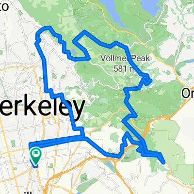
East Bay Century
A cycling route starting in Emeryville, California, United States of America.
Overview
About this route
- -:--
- Duration
- 168.8 km
- Distance
- 1,637 m
- Ascent
- 1,638 m
- Descent
- ---
- Avg. speed
- ---
- Avg. speed
Route quality
Waytypes & surfaces along the route
Waytypes
Busy road
79.6 km
(47 %)
Road
59.7 km
(35 %)
Surfaces
Paved
46.5 km
(28 %)
Unpaved
0.9 km
(<1 %)
Asphalt
41.4 km
(25 %)
Paved (undefined)
3.8 km
(2 %)
Route highlights
Points of interest along the route
Point of interest after 22.3 km
Point of interest after 70 km
Point of interest after 116.7 km
Windmill Farms Produce
Continue with Bikemap
Use, edit, or download this cycling route
You would like to ride East Bay Century or customize it for your own trip? Here is what you can do with this Bikemap route:
Free features
- Save this route as favorite or in collections
- Copy & plan your own version of this route
- Split it into stages to create a multi-day tour
- Sync your route with Garmin or Wahoo
Premium features
Free trial for 3 days, or one-time payment. More about Bikemap Premium.
- Navigate this route on iOS & Android
- Export a GPX / KML file of this route
- Create your custom printout (try it for free)
- Download this route for offline navigation
Discover more Premium features.
Get Bikemap PremiumFrom our community
Other popular routes starting in Emeryville
 Hill Loop
- Distance
- 40.1 km
- Ascent
- 691 m
- Descent
- 689 m
- Location
- Emeryville, California, United States of America
 Bay Trail to Shoreline
- Distance
- 11.8 km
- Ascent
- 42 m
- Descent
- 45 m
- Location
- Emeryville, California, United States of America
 Skyline trek along Redwood Park, southwest side
- Distance
- 31.8 km
- Ascent
- 521 m
- Descent
- 521 m
- Location
- Emeryville, California, United States of America
 redwood/chabot/joaquin miller mixed terrain
- Distance
- 63.7 km
- Ascent
- 980 m
- Descent
- 979 m
- Location
- Emeryville, California, United States of America
 to angel island then Mandela co op
- Distance
- 21.1 km
- Ascent
- 169 m
- Descent
- 170 m
- Location
- Emeryville, California, United States of America
 Park-Pinehurst Loop
- Distance
- 47.5 km
- Ascent
- 678 m
- Descent
- 676 m
- Location
- Emeryville, California, United States of America
 Lake Merritt
- Distance
- 4.2 km
- Ascent
- 4 m
- Descent
- 4 m
- Location
- Emeryville, California, United States of America
 Three Bears Loop
- Distance
- 78.5 km
- Ascent
- 1,147 m
- Descent
- 1,147 m
- Location
- Emeryville, California, United States of America
Open it in the app