

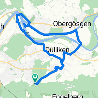
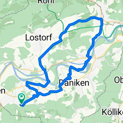
Schützenmattweg 12, Olten nach Forstackerstrasse 4F, Zofingen
A cycling route starting in Olten, Canton of Solothurn, Switzerland.
Overview
About this route
- 42 min
- Duration
- 10 km
- Distance
- 84 m
- Ascent
- 38 m
- Descent
- 14.3 km/h
- Avg. speed
- ---
- Max. altitude

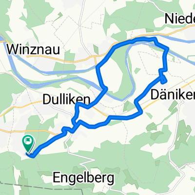
Route photos


Continue with Bikemap
Use, edit, or download this cycling route
You would like to ride Schützenmattweg 12, Olten nach Forstackerstrasse 4F, Zofingen or customize it for your own trip? Here is what you can do with this Bikemap route:
Free features
- Save this route as favorite or in collections
- Copy & plan your own version of this route
- Sync your route with Garmin or Wahoo
Premium features
Free trial for 3 days, or one-time payment. More about Bikemap Premium.
- Navigate this route on iOS & Android
- Export a GPX / KML file of this route
- Create your custom printout (try it for free)
- Download this route for offline navigation
Discover more Premium features.
Get Bikemap PremiumFrom our community
Other popular routes starting in Olten
 Säliring, Starrkirch-Wil nach Säliring, Starrkirch-Wil
- Distance
- 25.6 km
- Ascent
- 234 m
- Descent
- 233 m
- Location
- Olten, Canton of Solothurn, Switzerland
 Grenchenberg Corcelles Schelten
- Distance
- 149 km
- Ascent
- 2,318 m
- Descent
- 2,318 m
- Location
- Olten, Canton of Solothurn, Switzerland
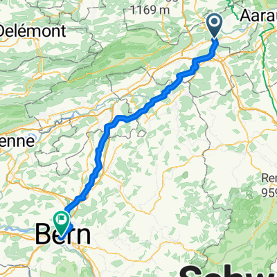 Olten - Bern
- Distance
- 72.4 km
- Ascent
- 599 m
- Descent
- 444 m
- Location
- Olten, Canton of Solothurn, Switzerland
 Route nach Hergiswil (Nidwalden)
- Distance
- 193 km
- Ascent
- 4,900 m
- Descent
- 4,857 m
- Location
- Olten, Canton of Solothurn, Switzerland
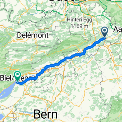 Olten - Nidau
- Distance
- 67.9 km
- Ascent
- 258 m
- Descent
- 228 m
- Location
- Olten, Canton of Solothurn, Switzerland
 Säliring, Starrkirch-Wil nach Säliring, Starrkirch-Wil
- Distance
- 13.4 km
- Ascent
- 124 m
- Descent
- 124 m
- Location
- Olten, Canton of Solothurn, Switzerland
 Säliring, Starrkirch-Wil nach Säliring, Starrkirch-Wil
- Distance
- 13.2 km
- Ascent
- 136 m
- Descent
- 138 m
- Location
- Olten, Canton of Solothurn, Switzerland
 Säliring, Starrkirch-Wil nach Säliring, Starrkirch-Wil
- Distance
- 25.7 km
- Ascent
- 250 m
- Descent
- 251 m
- Location
- Olten, Canton of Solothurn, Switzerland
Open it in the app