

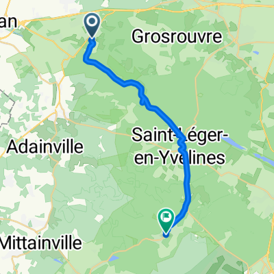
De 10 Chemin Saint-Aignan, Bourdonné à 8 Chemin Saint-Aignan, Bourdonné
A cycling route starting in Gambais, Île-de-France Region, France.
Overview
About this route
- 1 h 4 min
- Duration
- 13.5 km
- Distance
- 118 m
- Ascent
- 119 m
- Descent
- 12.6 km/h
- Avg. speed
- ---
- Max. altitude

Route quality
Waytypes & surfaces along the route
Waytypes
Track
7.4 km
(55 %)
Quiet road
5.1 km
(38 %)
Surfaces
Paved
0.6 km
(4 %)
Unpaved
4.8 km
(35 %)
Gravel
4.8 km
(35 %)
Paved (undefined)
0.6 km
(4 %)
Undefined
8.1 km
(60 %)
Continue with Bikemap
Use, edit, or download this cycling route
You would like to ride De 10 Chemin Saint-Aignan, Bourdonné à 8 Chemin Saint-Aignan, Bourdonné or customize it for your own trip? Here is what you can do with this Bikemap route:
Free features
- Save this route as favorite or in collections
- Copy & plan your own version of this route
- Sync your route with Garmin or Wahoo
Premium features
Free trial for 3 days, or one-time payment. More about Bikemap Premium.
- Navigate this route on iOS & Android
- Export a GPX / KML file of this route
- Create your custom printout (try it for free)
- Download this route for offline navigation
Discover more Premium features.
Get Bikemap PremiumFrom our community
Other popular routes starting in Gambais
 De 10 Chemin Saint-Aignan, Bourdonné à 8 Chemin Saint-Aignan, Bourdonné
- Distance
- 13.5 km
- Ascent
- 118 m
- Descent
- 119 m
- Location
- Gambais, Île-de-France Region, France
 Itinéraire modéré en
- Distance
- 12.5 km
- Ascent
- 152 m
- Descent
- 138 m
- Location
- Gambais, Île-de-France Region, France
 35 Rue des Hauts Champs, Gambais à 62 Rue de Rivoli, Paris
- Distance
- 59.8 km
- Ascent
- 403 m
- Descent
- 477 m
- Location
- Gambais, Île-de-France Region, France
 De 10 Chemin Saint-Aignan, Bourdonné à 10 Chemin Saint-Aignan, Bourdonné
- Distance
- 9.2 km
- Ascent
- 51 m
- Descent
- 53 m
- Location
- Gambais, Île-de-France Region, France
 Tour en forêt de Rambouillet au départ de Le Bloulay Gambais
- Distance
- 42.4 km
- Ascent
- 643 m
- Descent
- 642 m
- Location
- Gambais, Île-de-France Region, France
 Recovered Route
- Distance
- 18.1 km
- Ascent
- 305 m
- Descent
- 291 m
- Location
- Gambais, Île-de-France Region, France
 Géronimo Tour - 13966 - UtagawaVTT.com
- Distance
- 48.4 km
- Ascent
- 883 m
- Descent
- 882 m
- Location
- Gambais, Île-de-France Region, France
 Projet VÉLO PARIS
- Distance
- 59 km
- Ascent
- 398 m
- Descent
- 483 m
- Location
- Gambais, Île-de-France Region, France
Open it in the app