
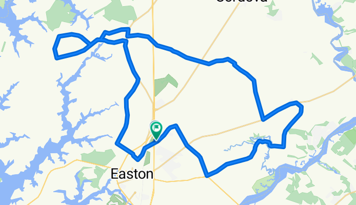
8957 Ocean Gateway, Easton to 8945 Sunflower Dr S, Easton
A cycling route starting in Easton, Maryland, United States.
Overview
About this route
- 2 h 36 min
- Duration
- 51.6 km
- Distance
- 6 m
- Ascent
- 26 m
- Descent
- 19.9 km/h
- Avg. speed
- ---
- Max. altitude

Route quality
Waytypes & surfaces along the route
Waytypes
Quiet road
37.7 km
(73 %)
Road
10.8 km
(21 %)
Undefined
3.1 km
(6 %)
Surfaces
Paved
16.5 km
(32 %)
Asphalt
16.5 km
(32 %)
Undefined
35.1 km
(68 %)
Continue with Bikemap
Use, edit, or download this cycling route
You would like to ride 8957 Ocean Gateway, Easton to 8945 Sunflower Dr S, Easton or customize it for your own trip? Here is what you can do with this Bikemap route:
Free features
- Save this route as favorite or in collections
- Copy & plan your own version of this route
- Sync your route with Garmin or Wahoo
Premium features
Free trial for 3 days, or one-time payment. More about Bikemap Premium.
- Navigate this route on iOS & Android
- Export a GPX / KML file of this route
- Create your custom printout (try it for free)
- Download this route for offline navigation
Discover more Premium features.
Get Bikemap PremiumFrom our community
Other popular routes starting in Easton
 Corbin, Dutchman's Lane to Hole In the Wall
- Distance
- 7.7 km
- Ascent
- 22 m
- Descent
- 26 m
- Location
- Easton, Maryland, United States
 Oxford Loop
- Distance
- 38.5 km
- Ascent
- 60 m
- Descent
- 60 m
- Location
- Easton, Maryland, United States
 Easton to St Michael
- Distance
- 16.6 km
- Ascent
- 35 m
- Descent
- 45 m
- Location
- Easton, Maryland, United States
 Corbin, Dutchman's Lane to St. Michaels
- Distance
- 20.8 km
- Ascent
- 37 m
- Descent
- 54 m
- Location
- Easton, Maryland, United States
 Traveler's Rest Route Out and Back
- Distance
- 25.2 km
- Ascent
- 78 m
- Descent
- 79 m
- Location
- Easton, Maryland, United States
 Talbot Farmland
- Distance
- 6.1 km
- Ascent
- 24 m
- Descent
- 18 m
- Location
- Easton, Maryland, United States
 School Days Easton Tour
- Distance
- 37.3 km
- Ascent
- 69 m
- Descent
- 69 m
- Location
- Easton, Maryland, United States
 Corbin Parkway to Bruceville Bridge
- Distance
- 25.7 km
- Ascent
- 88 m
- Descent
- 88 m
- Location
- Easton, Maryland, United States
Open it in the app