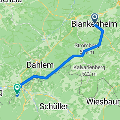
Vulkaneifelrunde
- 84.3 km
- 820 m
- 820 m
- Blankenheim, North Rhine-Westphalia, Germany
A cycling route starting in Blankenheim, North Rhine-Westphalia, Germany.
Overview
Route of Versatility
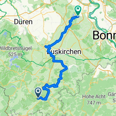
Length: 57 km With this cycling tour, I have chosen a route that is easy to manage even for families with children. Because on the way from Blankenheim-Wald to Weilerswist, it is almost all downhill. Only after Kall does one have to tackle the climb to Wallenthaler Höhe. The journey from Cologne to Blankenheim is by train. Right in front of the station, you hop into the saddle, and off you go. Places on the route: Blankenheim-Wald station - Nettersheim - Kall - Wallenthal - Hostel - Kommern - Obergatzem - Euskirchen - Weilerswistcreated this 15 years ago
Route quality
Track
26.9 km
(47 %)
Quiet road
13.7 km
(24 %)
Paved
40.6 km
(71 %)
Unpaved
10.3 km
(18 %)
Asphalt
36 km
(63 %)
Loose gravel
5.7 km
(10 %)
Route highlights

Radweg nach Nettersheim

Radweg nach Nettersheim

Nettersheim Waldspielplatz

Grüne Pütz > einer v. 7 Versorgungsbrunnen der Röm. Wasserleitung

Römische Wasserleitung aus dem Jahr 100n.Chr. Eifelwasserleitung Die Eifelwasserleitung – auch Römerkanal oder die Römische Wasserleitung nach Köln genannt – war eines der längsten Aquädukte des römischen Imperiums und gilt als größtes antikes Bauwerk nördlich der Alpen.

Bahnhof Kall

Mount Cloud

Feldweg bei Roggendorf

Firmenich - Brühler Strasse

Alter Markt

Die Erft bei Weilerswist Ottenheim
Continue with Bikemap
You would like to ride Route der Vielseitigkeit or customize it for your own trip? Here is what you can do with this Bikemap route:
Free trial for 3 days, or one-time payment. More about Bikemap Premium.
Discover more Premium features.
Get Bikemap PremiumFrom our community
Open it in the app