

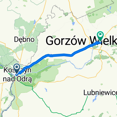
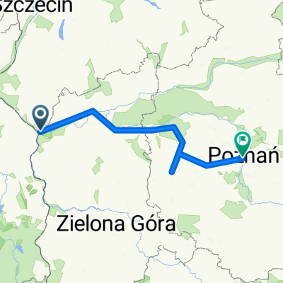
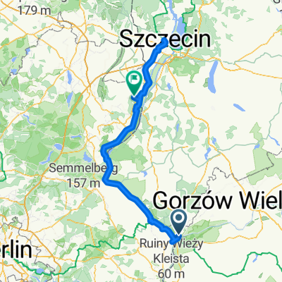
Wschodnia Brandenburgia II
A cycling route starting in Kostrzyn nad Odrą, Lubusz Voivodship, Poland.
Overview
About this route
- -:--
- Duration
- 202.3 km
- Distance
- 1,023 m
- Ascent
- 972 m
- Descent
- ---
- Avg. speed
- ---
- Max. altitude
Route quality
Waytypes & surfaces along the route
Waytypes
Quiet road
28.3 km
(14 %)
Path
26.3 km
(13 %)
Surfaces
Paved
153.7 km
(76 %)
Unpaved
14.2 km
(7 %)
Asphalt
147.7 km
(73 %)
Gravel
10.1 km
(5 %)
Continue with Bikemap
Use, edit, or download this cycling route
You would like to ride Wschodnia Brandenburgia II or customize it for your own trip? Here is what you can do with this Bikemap route:
Free features
- Save this route as favorite or in collections
- Copy & plan your own version of this route
- Split it into stages to create a multi-day tour
- Sync your route with Garmin or Wahoo
Premium features
Free trial for 3 days, or one-time payment. More about Bikemap Premium.
- Navigate this route on iOS & Android
- Export a GPX / KML file of this route
- Create your custom printout (try it for free)
- Download this route for offline navigation
Discover more Premium features.
Get Bikemap PremiumFrom our community
Other popular routes starting in Kostrzyn nad Odrą
 Orła Białego, Kostrzyn nad Odrą do Oderstraße, Bad Freienwalde
- Distance
- 58.4 km
- Ascent
- 19 m
- Descent
- 25 m
- Location
- Kostrzyn nad Odrą, Lubusz Voivodship, Poland
 Polen Lebus Nord Kurz
- Distance
- 234.5 km
- Ascent
- 433 m
- Descent
- 433 m
- Location
- Kostrzyn nad Odrą, Lubusz Voivodship, Poland
 Etappe 3
- Distance
- 47.8 km
- Ascent
- 139 m
- Descent
- 131 m
- Location
- Kostrzyn nad Odrą, Lubusz Voivodship, Poland
 Küstrin–Posen (Gesamtroute)
- Distance
- 213.3 km
- Ascent
- 0 m
- Descent
- 0 m
- Location
- Kostrzyn nad Odrą, Lubusz Voivodship, Poland
 Wysoka Kamieńska 2024 (20-22.07)
- Distance
- 358.9 km
- Ascent
- 1,726 m
- Descent
- 1,728 m
- Location
- Kostrzyn nad Odrą, Lubusz Voivodship, Poland
 M Kopernika, Kostrzyn to Hohenselchow, Hohenselchow-Groß Pinnow
- Distance
- 190.2 km
- Ascent
- 553 m
- Descent
- 570 m
- Location
- Kostrzyn nad Odrą, Lubusz Voivodship, Poland
 Kostrzyn-Żary Część dookoła polski
- Distance
- 193.9 km
- Ascent
- 413 m
- Descent
- 274 m
- Location
- Kostrzyn nad Odrą, Lubusz Voivodship, Poland
 leśno-asfaltowa
- Distance
- 36 km
- Ascent
- 165 m
- Descent
- 165 m
- Location
- Kostrzyn nad Odrą, Lubusz Voivodship, Poland
Open it in the app