
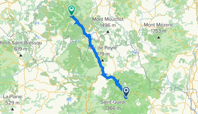
De Le Mas Soubeyran, Molezon à 19 Route du Puy Mary, Dienne
A cycling route starting in Florac, Occitanie, France.
Overview
About this route
- 12 h 32 min
- Duration
- 177.1 km
- Distance
- 2,156 m
- Ascent
- 1,774 m
- Descent
- 14.1 km/h
- Avg. speed
- ---
- Max. altitude

Route quality
Waytypes & surfaces along the route
Waytypes
Road
85 km
(48 %)
Quiet road
42.5 km
(24 %)
Surfaces
Paved
42.5 km
(24 %)
Unpaved
10.6 km
(6 %)
Asphalt
40.7 km
(23 %)
Gravel
7.1 km
(4 %)
Continue with Bikemap
Use, edit, or download this cycling route
You would like to ride De Le Mas Soubeyran, Molezon à 19 Route du Puy Mary, Dienne or customize it for your own trip? Here is what you can do with this Bikemap route:
Free features
- Save this route as favorite or in collections
- Copy & plan your own version of this route
- Split it into stages to create a multi-day tour
- Sync your route with Garmin or Wahoo
Premium features
Free trial for 3 days, or one-time payment. More about Bikemap Premium.
- Navigate this route on iOS & Android
- Export a GPX / KML file of this route
- Create your custom printout (try it for free)
- Download this route for offline navigation
Discover more Premium features.
Get Bikemap PremiumFrom our community
Other popular routes starting in Florac
 Südfrankreich 2011: 8 - Florac - Alès über Corniche des Cévennes
- Distance
- 96.1 km
- Ascent
- 904 m
- Descent
- 1,310 m
- Location
- Florac, Occitanie, France
 Sept2021 - 1/5
- Distance
- 106.5 km
- Ascent
- 1,683 m
- Descent
- 1,678 m
- Location
- Florac, Occitanie, France
 Sept2021 - 5/5bis
- Distance
- 161.1 km
- Ascent
- 2,864 m
- Descent
- 2,847 m
- Location
- Florac, Occitanie, France
 LOZERE-TARN 94KM - rte des gorges du tarn
- Distance
- 94 km
- Ascent
- 1,014 m
- Descent
- 1,014 m
- Location
- Florac, Occitanie, France
 2016 Ride Day 160 - Ispagnac to Rivière-sur-Tarn
- Distance
- 64.3 km
- Ascent
- 789 m
- Descent
- 935 m
- Location
- Florac, Occitanie, France
 Barre de Cevennes - Col de Finiels
- Distance
- 41.7 km
- Ascent
- 1,223 m
- Descent
- 622 m
- Location
- Florac, Occitanie, France
 Florac la Malene
- Distance
- 96.3 km
- Ascent
- 1,000 m
- Descent
- 996 m
- Location
- Florac, Occitanie, France
 LOZERE - TARN - gorges de la jonte (meyrueis) 112kms
- Distance
- 111.7 km
- Ascent
- 1,403 m
- Descent
- 1,403 m
- Location
- Florac, Occitanie, France
Open it in the app