

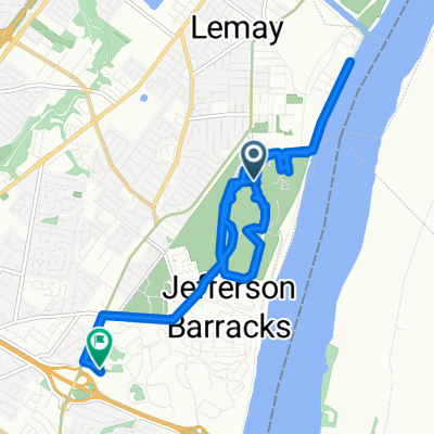
Grant's Trail - River Des Peres Greenway Connector
A cycling route starting in Lemay, Missouri, United States of America.
Overview
About this route
Although not shown on the map, this is a full loop. Grant's Trail does now extend east to the River Des Peres Greenway - it follows a route parallel to I-55.
Parking at any location is acceptable, but I personally suggest at the Grant's Trail Parking location at the Southern portion. The trail may also be accessed by the Metro, as the Shrewsbury line ends directly at the intersection of River Des Peres Blvd and Lansdowne Ave along the route.
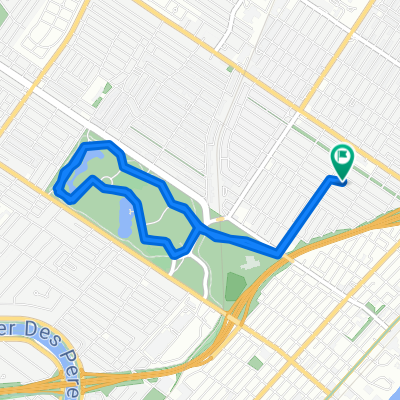
I highly recommend stopping for food at either the Kirkwood Farmers Market (1 mile west on Argonne Dr.), downtown Webster Groves (on route), or downtown Maplewood (.5 mile north on Sutton Blvd.).
The trail can be started in either direction, although I recommend heading clockwise for the sake of being on the correct side of the road.
- -:--
- Duration
- 35.8 km
- Distance
- 167 m
- Ascent
- 166 m
- Descent
- ---
- Avg. speed
- ---
- Max. altitude

Route quality
Waytypes & surfaces along the route
Waytypes
Cycleway
25.7 km
(72 %)
Quiet road
4.8 km
(13 %)
Surfaces
Paved
24 km
(67 %)
Asphalt
17.1 km
(48 %)
Paved (undefined)
6.8 km
(19 %)
Continue with Bikemap
Use, edit, or download this cycling route
You would like to ride Grant's Trail - River Des Peres Greenway Connector or customize it for your own trip? Here is what you can do with this Bikemap route:
Free features
- Save this route as favorite or in collections
- Copy & plan your own version of this route
- Sync your route with Garmin or Wahoo
Premium features
Free trial for 3 days, or one-time payment. More about Bikemap Premium.
- Navigate this route on iOS & Android
- Export a GPX / KML file of this route
- Create your custom printout (try it for free)
- Download this route for offline navigation
Discover more Premium features.
Get Bikemap PremiumFrom our community
Other popular routes starting in Lemay
 Minnesota Avenue 6517, St. Louis to Leffingwell Avenue 360, Kirkwood
- Distance
- 16.4 km
- Ascent
- 171 m
- Descent
- 124 m
- Location
- Lemay, Missouri, United States of America
 stlcc from house
- Distance
- 10.4 km
- Ascent
- 125 m
- Descent
- 111 m
- Location
- Lemay, Missouri, United States of America
 River City Casino Blvd, Saint Louis to 5328 Lode Ave, Saint Louis
- Distance
- 8.7 km
- Ascent
- 77 m
- Descent
- 55 m
- Location
- Lemay, Missouri, United States of America
 Recovered Route
- Distance
- 14.6 km
- Ascent
- 115 m
- Descent
- 115 m
- Location
- Lemay, Missouri, United States of America
 Grant's Trail - River Des Peres Greenway Connector
- Distance
- 36.4 km
- Ascent
- 339 m
- Descent
- 337 m
- Location
- Lemay, Missouri, United States of America
 Tons of Parks
- Distance
- 64.6 km
- Ascent
- 276 m
- Descent
- 265 m
- Location
- Lemay, Missouri, United States of America
 Dover Pl, St. Louis to Dover Pl, St. Louis
- Distance
- 10.6 km
- Ascent
- 82 m
- Descent
- 86 m
- Location
- Lemay, Missouri, United States of America
 5217 Gravois Ave, St. Louis to 3950 Potomac St, St. Louis
- Distance
- 2.5 km
- Ascent
- 23 m
- Descent
- 14 m
- Location
- Lemay, Missouri, United States of America
Open it in the app