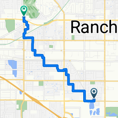
Malaga Drive 11755, Rancho Cucamonga to Leasing Office, Rancho Cucamonga
A cycling route starting in Rancho Cucamonga, California, United States of America.
Overview
About this route
- 3 h 34 min
- Duration
- 64.3 km
- Distance
- 345 m
- Ascent
- 344 m
- Descent
- 18 km/h
- Avg. speed
- ---
- Avg. speed
Route photos
Route quality
Waytypes & surfaces along the route
Waytypes
Cycleway
25.2 km
(39 %)
Pedestrian area
13.6 km
(21 %)
Surfaces
Paved
46.5 km
(72 %)
Unpaved
0.1 km
(<1 %)
Asphalt
27.7 km
(43 %)
Concrete
15.4 km
(24 %)
Continue with Bikemap
Use, edit, or download this cycling route
You would like to ride Malaga Drive 11755, Rancho Cucamonga to Leasing Office, Rancho Cucamonga or customize it for your own trip? Here is what you can do with this Bikemap route:
Free features
- Save this route as favorite or in collections
- Copy & plan your own version of this route
- Sync your route with Garmin or Wahoo
Premium features
Free trial for 3 days, or one-time payment. More about Bikemap Premium.
- Navigate this route on iOS & Android
- Export a GPX / KML file of this route
- Create your custom printout (try it for free)
- Download this route for offline navigation
Discover more Premium features.
Get Bikemap PremiumFrom our community
Other popular routes starting in Rancho Cucamonga
- Malaga Drive 11755, Rancho Cucamonga to Leasing Office, Rancho Cucamonga
- Distance
- 64.3 km
- Ascent
- 345 m
- Descent
- 344 m
- Location
- Rancho Cucamonga, California, United States of America
- Recording from January 24, 10:51 AM
- Distance
- 14.9 km
- Ascent
- 465 m
- Descent
- 466 m
- Location
- Rancho Cucamonga, California, United States of America
- fun
- Distance
- 11.3 km
- Ascent
- 46 m
- Descent
- 86 m
- Location
- Rancho Cucamonga, California, United States of America
- ride through Rancho Cucamonga
- Distance
- 14.9 km
- Ascent
- 460 m
- Descent
- 459 m
- Location
- Rancho Cucamonga, California, United States of America
- 7.Ontario . Mount Baldy
- Distance
- 129.6 km
- Ascent
- 3,042 m
- Descent
- 1,426 m
- Location
- Rancho Cucamonga, California, United States of America
- Recording from January 10, 9:39 AM
- Distance
- 19.9 km
- Ascent
- 441 m
- Descent
- 440 m
- Location
- Rancho Cucamonga, California, United States of America
- Recording from November 1, 6:10 AM
- Distance
- 38.2 km
- Ascent
- 397 m
- Descent
- 397 m
- Location
- Rancho Cucamonga, California, United States of America
- Recording from January 30, 10:07 AM
- Distance
- 22.1 km
- Ascent
- 482 m
- Descent
- 482 m
- Location
- Rancho Cucamonga, California, United States of America