

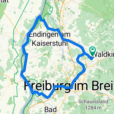
Rund um den Kaiserstuhl
A cycling route starting in Sexau, Baden-Wurttemberg, Germany.
Overview
About this route
- 6 h 30 min
- Duration
- 97.3 km
- Distance
- 127 m
- Ascent
- 127 m
- Descent
- 15 km/h
- Avg. speed
- ---
- Max. altitude

Route quality
Waytypes & surfaces along the route
Waytypes
Track
39.9 km
(41 %)
Path
31.2 km
(32 %)
Surfaces
Paved
57.7 km
(59 %)
Unpaved
28.7 km
(29 %)
Asphalt
40.8 km
(42 %)
Gravel
25.9 km
(27 %)
Continue with Bikemap
Use, edit, or download this cycling route
You would like to ride Rund um den Kaiserstuhl or customize it for your own trip? Here is what you can do with this Bikemap route:
Free features
- Save this route as favorite or in collections
- Copy & plan your own version of this route
- Split it into stages to create a multi-day tour
- Sync your route with Garmin or Wahoo
Premium features
Free trial for 3 days, or one-time payment. More about Bikemap Premium.
- Navigate this route on iOS & Android
- Export a GPX / KML file of this route
- Create your custom printout (try it for free)
- Download this route for offline navigation
Discover more Premium features.
Get Bikemap PremiumFrom our community
Other popular routes starting in Sexau
 Kandelrunde
- Distance
- 40 km
- Ascent
- 1,084 m
- Descent
- 1,086 m
- Location
- Sexau, Baden-Wurttemberg, Germany
 Sexau-Kandelspitze
- Distance
- 16.5 km
- Ascent
- 1,102 m
- Descent
- 101 m
- Location
- Sexau, Baden-Wurttemberg, Germany
 Schwarzwaldtour 2013 - Etappe3
- Distance
- 91.8 km
- Ascent
- 655 m
- Descent
- 653 m
- Location
- Sexau, Baden-Wurttemberg, Germany
 1DE_Waldkirsch_Simonswald_St_Mergen_Glottertal
- Distance
- 63.5 km
- Ascent
- 709 m
- Descent
- 712 m
- Location
- Sexau, Baden-Wurttemberg, Germany
 Reute, Eichstetten, Wasenweiler, Gottenheim, BuchholzUmkirch,
- Distance
- 47.7 km
- Ascent
- 93 m
- Descent
- 93 m
- Location
- Sexau, Baden-Wurttemberg, Germany
 Schauinsland
- Distance
- 77.2 km
- Ascent
- 1,329 m
- Descent
- 1,329 m
- Location
- Sexau, Baden-Wurttemberg, Germany
 Rund um den Kaiserstuhl
- Distance
- 97.3 km
- Ascent
- 127 m
- Descent
- 127 m
- Location
- Sexau, Baden-Wurttemberg, Germany
 Waldkirch-Sexau-Tennenbach-Mußbach-Gscheid-Waldkirch
- Distance
- 35.4 km
- Ascent
- 496 m
- Descent
- 480 m
- Location
- Sexau, Baden-Wurttemberg, Germany
Open it in the app