

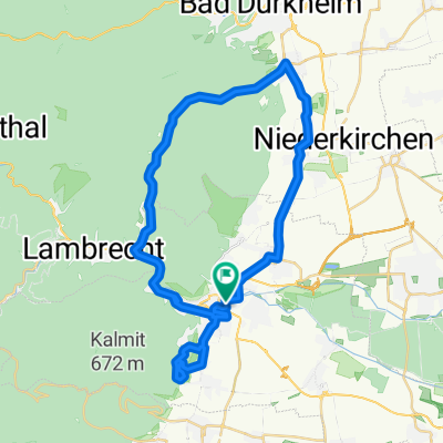
BRT2019-Do: Zwischen Wald und Reben - RTF des BRT2019-Do - 74 km Strecke
A cycling route starting in Neustadt an der Weinstraße, Rhineland-Palatinate, Germany.
Overview
About this route
BRT2019-Do: Between forest and vineyards - 74 km route
RTF of the BRT2019-Do
All further information about this route -> click here
- -:--
- Duration
- 74.6 km
- Distance
- 1,854 m
- Ascent
- 1,854 m
- Descent
- ---
- Avg. speed
- 284 m
- Max. altitude

Route quality
Waytypes & surfaces along the route
Waytypes
Road
22.4 km
(30 %)
Track
13.4 km
(18 %)
Surfaces
Paved
63.4 km
(85 %)
Unpaved
1.5 km
(2 %)
Asphalt
58.9 km
(79 %)
Paved (undefined)
3.7 km
(5 %)
Route highlights
Points of interest along the route
Drinking water after 34.4 km
Kontrolle
Drinking water after 55.6 km
Kontrolle
Continue with Bikemap
Use, edit, or download this cycling route
You would like to ride BRT2019-Do: Zwischen Wald und Reben - RTF des BRT2019-Do - 74 km Strecke or customize it for your own trip? Here is what you can do with this Bikemap route:
Free features
- Save this route as favorite or in collections
- Copy & plan your own version of this route
- Sync your route with Garmin or Wahoo
Premium features
Free trial for 3 days, or one-time payment. More about Bikemap Premium.
- Navigate this route on iOS & Android
- Export a GPX / KML file of this route
- Create your custom printout (try it for free)
- Download this route for offline navigation
Discover more Premium features.
Get Bikemap PremiumFrom our community
Other popular routes starting in Neustadt an der Weinstraße
 Hambacher Schloss, Wachenheimer Tal
- Distance
- 40.5 km
- Ascent
- 911 m
- Descent
- 907 m
- Location
- Neustadt an der Weinstraße, Rhineland-Palatinate, Germany
 Kalmitrunde
- Distance
- 25.9 km
- Ascent
- 808 m
- Descent
- 808 m
- Location
- Neustadt an der Weinstraße, Rhineland-Palatinate, Germany
 Waldstraße nach Waldstraße
- Distance
- 63.5 km
- Ascent
- 807 m
- Descent
- 839 m
- Location
- Neustadt an der Weinstraße, Rhineland-Palatinate, Germany
 Neustadt - Kalmitrunde
- Distance
- 30.6 km
- Ascent
- 840 m
- Descent
- 842 m
- Location
- Neustadt an der Weinstraße, Rhineland-Palatinate, Germany
 Deutschen Weinstraße Tag2
- Distance
- 52.3 km
- Ascent
- 238 m
- Descent
- 261 m
- Location
- Neustadt an der Weinstraße, Rhineland-Palatinate, Germany
 BRT2019-Sa: Zur Radrennbahn und zum Rhein - 50 km Strecke
- Distance
- 50.3 km
- Ascent
- 82 m
- Descent
- 82 m
- Location
- Neustadt an der Weinstraße, Rhineland-Palatinate, Germany
 Neustadt - Kalmitrunde
- Distance
- 30.6 km
- Ascent
- 836 m
- Descent
- 839 m
- Location
- Neustadt an der Weinstraße, Rhineland-Palatinate, Germany
 Waldstraße nach Waldstraße
- Distance
- 63.6 km
- Ascent
- 796 m
- Descent
- 839 m
- Location
- Neustadt an der Weinstraße, Rhineland-Palatinate, Germany
Open it in the app