
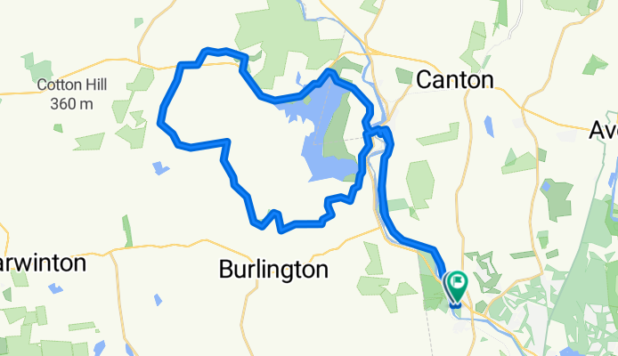
Unionville - South Rd
A cycling route starting in Collinsville, Connecticut, United States of America.
Overview
About this route
- -:--
- Duration
- 39.4 km
- Distance
- 394 m
- Ascent
- 389 m
- Descent
- ---
- Avg. speed
- ---
- Max. altitude

Route photos


Route quality
Waytypes & surfaces along the route
Waytypes
Quiet road
21.3 km
(54 %)
Road
12.8 km
(33 %)
Surfaces
Paved
13.8 km
(35 %)
Asphalt
13.7 km
(35 %)
Concrete
0.1 km
(<1 %)
Undefined
25.6 km
(65 %)
Route highlights
Points of interest along the route

Point of interest after 10.2 km
No water going over the Nepaug dam

Point of interest after 10.2 km
Nepaug Reservoir & dam
Continue with Bikemap
Use, edit, or download this cycling route
You would like to ride Unionville - South Rd or customize it for your own trip? Here is what you can do with this Bikemap route:
Free features
- Save this route as favorite or in collections
- Copy & plan your own version of this route
- Sync your route with Garmin or Wahoo
Premium features
Free trial for 3 days, or one-time payment. More about Bikemap Premium.
- Navigate this route on iOS & Android
- Export a GPX / KML file of this route
- Create your custom printout (try it for free)
- Download this route for offline navigation
Discover more Premium features.
Get Bikemap PremiumFrom our community
Other popular routes starting in Collinsville
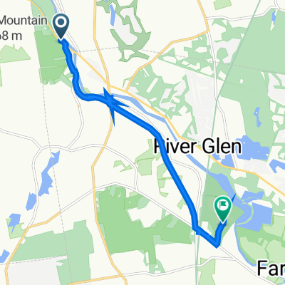
 collinsville to farminton
- Distance
- 15.1 km
- Ascent
- 49 m
- Descent
- 83 m
- Location
- Collinsville, Connecticut, United States of America
 Unionville - South Rd
- Distance
- 39.4 km
- Ascent
- 394 m
- Descent
- 389 m
- Location
- Collinsville, Connecticut, United States of America
 Nepaug & Huckleberry 200915
- Distance
- 38.2 km
- Ascent
- 794 m
- Descent
- 791 m
- Location
- Collinsville, Connecticut, United States of America
 Farmington River Trail, Unionville to 8973 Tunxis Mead Rd, Farmington
- Distance
- 8.6 km
- Ascent
- 231 m
- Descent
- 245 m
- Location
- Collinsville, Connecticut, United States of America
 Huckleberry Hill Rd, Avon to Emily Way, West Hartford
- Distance
- 38.2 km
- Ascent
- 324 m
- Descent
- 328 m
- Location
- Collinsville, Connecticut, United States of America
 Nepaug & Huckleberry
- Distance
- 37.7 km
- Ascent
- 531 m
- Descent
- 532 m
- Location
- Collinsville, Connecticut, United States of America
 C-Ville 28mi.
- Distance
- 41.7 km
- Ascent
- 392 m
- Descent
- 380 m
- Location
- Collinsville, Connecticut, United States of America
 airport short loop
- Distance
- 29.3 km
- Ascent
- 434 m
- Descent
- 447 m
- Location
- Collinsville, Connecticut, United States of America
Open it in the app