

Plan bis
A cycling route starting in Thuin, Wallonia, Belgium.
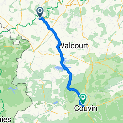
Overview
About this route
- -:--
- Duration
- 41.7 km
- Distance
- 370 m
- Ascent
- 335 m
- Descent
- ---
- Avg. speed
- ---
- Max. altitude

Route quality
Waytypes & surfaces along the route
Waytypes
Quiet road
15.9 km
(38 %)
Cycleway
9.2 km
(22 %)
Surfaces
Paved
21.3 km
(51 %)
Asphalt
20.4 km
(49 %)
Concrete
0.8 km
(2 %)
Undefined
20.4 km
(49 %)
Route highlights
Points of interest along the route
Point of interest after 21.3 km
Le crocodile café
Point of interest after 21.3 km
Le Robin's café
Point of interest after 25.2 km
Café de la Place
Point of interest after 25.2 km
Le relais de Cerfontaine
Point of interest after 25.5 km
Café B17
Point of interest after 25.7 km
Lydie
Point of interest after 25.9 km
La Besace
Continue with Bikemap
Use, edit, or download this cycling route
You would like to ride Plan bis or customize it for your own trip? Here is what you can do with this Bikemap route:
Free features
- Save this route as favorite or in collections
- Copy & plan your own version of this route
- Sync your route with Garmin or Wahoo
Premium features
Free trial for 3 days, or one-time payment. More about Bikemap Premium.
- Navigate this route on iOS & Android
- Export a GPX / KML file of this route
- Create your custom printout (try it for free)
- Download this route for offline navigation
Discover more Premium features.
Get Bikemap PremiumFrom our community
Other popular routes starting in Thuin
 Thuin - Namur
- Distance
- 59.3 km
- Ascent
- 207 m
- Descent
- 261 m
- Location
- Thuin, Wallonia, Belgium
 Route in Thuin
- Distance
- 81.3 km
- Ascent
- 681 m
- Descent
- 683 m
- Location
- Thuin, Wallonia, Belgium
 Ballade 20Km Thuin/Ragnies/Biercée
- Distance
- 20.6 km
- Ascent
- 143 m
- Descent
- 139 m
- Location
- Thuin, Wallonia, Belgium
 Biercée -Bousignies Sambre Biercée
- Distance
- 35.9 km
- Ascent
- 230 m
- Descent
- 230 m
- Location
- Thuin, Wallonia, Belgium
 rondje pasen 2023
- Distance
- 334.5 km
- Ascent
- 2,134 m
- Descent
- 2,132 m
- Location
- Thuin, Wallonia, Belgium
 2019 Belgique optie dag 4
- Distance
- 78.6 km
- Ascent
- 530 m
- Descent
- 530 m
- Location
- Thuin, Wallonia, Belgium
 Ragnies- Parcours d'exploration au coeur de la Thudinie
- Distance
- 34.6 km
- Ascent
- 177 m
- Descent
- 179 m
- Location
- Thuin, Wallonia, Belgium
 Plan bis
- Distance
- 41.7 km
- Ascent
- 370 m
- Descent
- 335 m
- Location
- Thuin, Wallonia, Belgium
Open it in the app