
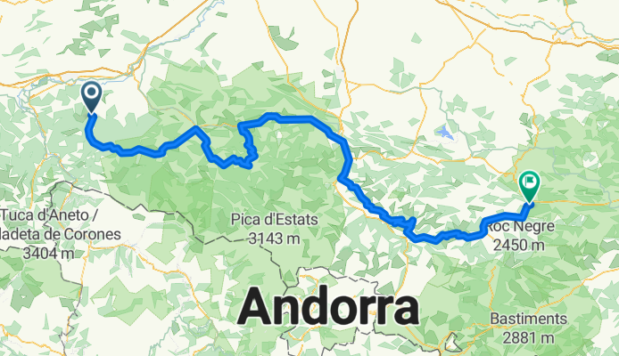
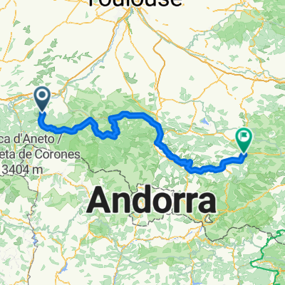
Aspet - Axat
A cycling route starting in Aspet, Occitanie, France.
Overview
About this route
- -:--
- Duration
- 225.4 km
- Distance
- 3,624 m
- Ascent
- 3,623 m
- Descent
- ---
- Avg. speed
- ---
- Max. altitude

Route highlights
Points of interest along the route
Point of interest after 16.8 km
Portet-d'Aspet
Point of interest after 78.3 km
crouzette
Point of interest after 170.6 km
chioula
Point of interest after 191.1 km
pailhères
Continue with Bikemap
Use, edit, or download this cycling route
You would like to ride Aspet - Axat or customize it for your own trip? Here is what you can do with this Bikemap route:
Free features
- Save this route as favorite or in collections
- Copy & plan your own version of this route
- Split it into stages to create a multi-day tour
- Sync your route with Garmin or Wahoo
Premium features
Free trial for 3 days, or one-time payment. More about Bikemap Premium.
- Navigate this route on iOS & Android
- Export a GPX / KML file of this route
- Create your custom printout (try it for free)
- Download this route for offline navigation
Discover more Premium features.
Get Bikemap PremiumFrom our community
Other popular routes starting in Aspet
 2012 T5
- Distance
- 113.1 km
- Ascent
- 1,101 m
- Descent
- 1,104 m
- Location
- Aspet, Occitanie, France
 Ride Day 14—24 Sept 2005—09800 Saint-Lary to 09000 Col des Marrous – Le Bosc – Foix
- Distance
- 62.7 km
- Ascent
- 1,118 m
- Descent
- 809 m
- Location
- Aspet, Occitanie, France
 CATFR_2022_Tag3_StLary_PortetDAspet_Vielha
- Distance
- 60.6 km
- Ascent
- 1,862 m
- Descent
- 1,577 m
- Location
- Aspet, Occitanie, France
 Circuit n° 1 :St Béat/Balès/Portillon/St Béat 93Km
- Distance
- 93 km
- Ascent
- 2,939 m
- Descent
- 2,600 m
- Location
- Aspet, Occitanie, France
 Tp1 chaum-seix
- Distance
- 82.3 km
- Ascent
- 1,871 m
- Descent
- 1,836 m
- Location
- Aspet, Occitanie, France
 Aspet - Axat
- Distance
- 225.4 km
- Ascent
- 3,624 m
- Descent
- 3,623 m
- Location
- Aspet, Occitanie, France
 Fronsac - Bielle
- Distance
- 209.3 km
- Ascent
- 5,029 m
- Descent
- 5,058 m
- Location
- Aspet, Occitanie, France
 TDP - ETAPE 9
- Distance
- 80.3 km
- Ascent
- 1,541 m
- Descent
- 1,786 m
- Location
- Aspet, Occitanie, France
Open it in the app