

Grand Est: Tieffenbach bis Güdingen
A cycling route starting in Diemeringen, Grand Est, France.
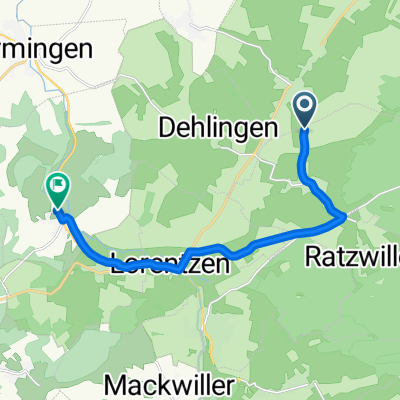
Overview
About this route
From Saargemünd by TER to Tieffenbach, back by bike
- -:--
- Duration
- 52.8 km
- Distance
- 78 m
- Ascent
- 133 m
- Descent
- ---
- Avg. speed
- ---
- Max. altitude

Route quality
Waytypes & surfaces along the route
Waytypes
Cycleway
14.3 km
(27 %)
Access road
11.6 km
(22 %)
Surfaces
Paved
48 km
(91 %)
Unpaved
0.5 km
(1 %)
Asphalt
45.9 km
(87 %)
Paved (undefined)
1.6 km
(3 %)
Continue with Bikemap
Use, edit, or download this cycling route
You would like to ride Grand Est: Tieffenbach bis Güdingen or customize it for your own trip? Here is what you can do with this Bikemap route:
Free features
- Save this route as favorite or in collections
- Copy & plan your own version of this route
- Sync your route with Garmin or Wahoo
Premium features
Free trial for 3 days, or one-time payment. More about Bikemap Premium.
- Navigate this route on iOS & Android
- Export a GPX / KML file of this route
- Create your custom printout (try it for free)
- Download this route for offline navigation
Discover more Premium features.
Get Bikemap PremiumFrom our community
Other popular routes starting in Diemeringen
 Thal-Baerenthal Rundkurs 117km
- Distance
- 113.1 km
- Ascent
- 1,554 m
- Descent
- 1,531 m
- Location
- Diemeringen, Grand Est, France
 Test2
Test2- Distance
- 8.6 km
- Ascent
- 137 m
- Descent
- 76 m
- Location
- Diemeringen, Grand Est, France
 Lorenzen
- Distance
- 45.5 km
- Ascent
- 277 m
- Descent
- 313 m
- Location
- Diemeringen, Grand Est, France
 Tieffenbach-Fegersheim
- Distance
- 86.5 km
- Ascent
- 249 m
- Descent
- 348 m
- Location
- Diemeringen, Grand Est, France
 Recovered Route
- Distance
- 17.7 km
- Ascent
- 228 m
- Descent
- 115 m
- Location
- Diemeringen, Grand Est, France
 4 Ruelle du Pacage, Diemeringen à 14 Rue des Potiers, Diemeringen
- Distance
- 40.3 km
- Ascent
- 734 m
- Descent
- 734 m
- Location
- Diemeringen, Grand Est, France
 Lorentzen to Diebling
- Distance
- 102 km
- Ascent
- 833 m
- Descent
- 820 m
- Location
- Diemeringen, Grand Est, France
 Route stable en Voellerdingen
- Distance
- 12.4 km
- Ascent
- 360 m
- Descent
- 383 m
- Location
- Diemeringen, Grand Est, France
Open it in the app