

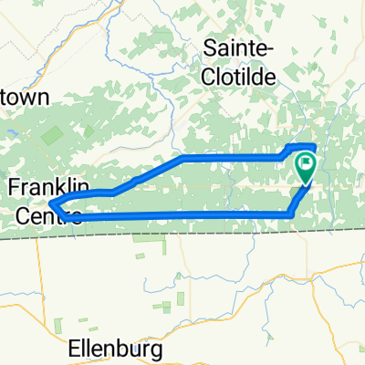
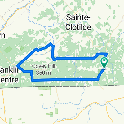
Covey Hill Hemmingford /Franklin
A cycling route starting in Lacolle, Quebec, Canada.
Overview
About this route
- -:--
- Duration
- 76.5 km
- Distance
- 436 m
- Ascent
- 436 m
- Descent
- ---
- Avg. speed
- ---
- Max. altitude

Route quality
Waytypes & surfaces along the route
Waytypes
Busy road
37.7 km
(49 %)
Road
29.8 km
(39 %)
Surfaces
Paved
24.2 km
(32 %)
Asphalt
17 km
(22 %)
Paved (undefined)
7.2 km
(9 %)
Undefined
52.3 km
(68 %)
Route highlights
Points of interest along the route

Photo after 19.2 km
Continue with Bikemap
Use, edit, or download this cycling route
You would like to ride Covey Hill Hemmingford /Franklin or customize it for your own trip? Here is what you can do with this Bikemap route:
Free features
- Save this route as favorite or in collections
- Copy & plan your own version of this route
- Sync your route with Garmin or Wahoo
Premium features
Free trial for 3 days, or one-time payment. More about Bikemap Premium.
- Navigate this route on iOS & Android
- Export a GPX / KML file of this route
- Create your custom printout (try it for free)
- Download this route for offline navigation
Discover more Premium features.
Get Bikemap PremiumFrom our community
Other popular routes starting in Lacolle
 Covey Hill - Short
- Distance
- 61.2 km
- Ascent
- 334 m
- Descent
- 332 m
- Location
- Lacolle, Quebec, Canada
 Lacolle - Covey Hill (SG)
- Distance
- 109.4 km
- Ascent
- 382 m
- Descent
- 381 m
- Location
- Lacolle, Quebec, Canada
 Covey Hill 2014
- Distance
- 63.3 km
- Ascent
- 362 m
- Descent
- 365 m
- Location
- Lacolle, Quebec, Canada
 lake Champlain 250 Km
- Distance
- 251.3 km
- Ascent
- 1,238 m
- Descent
- 1,243 m
- Location
- Lacolle, Quebec, Canada
 Lac Champlain
- Distance
- 108.3 km
- Ascent
- 160 m
- Descent
- 160 m
- Location
- Lacolle, Quebec, Canada
 Covey Hill
- Distance
- 94.2 km
- Ascent
- 422 m
- Descent
- 458 m
- Location
- Lacolle, Quebec, Canada
 CLemay_Hemmingford-1
- Distance
- 64.1 km
- Ascent
- 332 m
- Descent
- 333 m
- Location
- Lacolle, Quebec, Canada
 Covey Hill
- Distance
- 85.1 km
- Ascent
- 360 m
- Descent
- 360 m
- Location
- Lacolle, Quebec, Canada
Open it in the app