

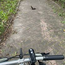
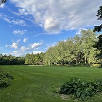
夏 帯広 三国峠 美瑛
A cycling route starting in Obihiro, Hokkaido, Japan.
Overview
About this route
good
- -:--
- Duration
- 411 km
- Distance
- 1,832 m
- Ascent
- 1,850 m
- Descent
- ---
- Avg. speed
- ---
- Max. altitude

Route quality
Waytypes & surfaces along the route
Waytypes
Quiet road
143.9 km
(35 %)
Road
106.9 km
(26 %)
Surfaces
Paved
98.6 km
(24 %)
Unpaved
4.1 km
(1 %)
Asphalt
69.9 km
(17 %)
Paved (undefined)
28.8 km
(7 %)
Continue with Bikemap
Use, edit, or download this cycling route
You would like to ride 夏 帯広 三国峠 美瑛 or customize it for your own trip? Here is what you can do with this Bikemap route:
Free features
- Save this route as favorite or in collections
- Copy & plan your own version of this route
- Split it into stages to create a multi-day tour
- Sync your route with Garmin or Wahoo
Premium features
Free trial for 3 days, or one-time payment. More about Bikemap Premium.
- Navigate this route on iOS & Android
- Export a GPX / KML file of this route
- Create your custom printout (try it for free)
- Download this route for offline navigation
Discover more Premium features.
Get Bikemap PremiumFrom our community
Other popular routes starting in Obihiro
 帶廣到然別湖
- Distance
- 64.6 km
- Ascent
- 904 m
- Descent
- 131 m
- Location
- Obihiro, Hokkaido, Japan
 Day 14
- Distance
- 88.4 km
- Ascent
- 220 m
- Descent
- 259 m
- Location
- Obihiro, Hokkaido, Japan
 一般道道十勝川温泉帯広自転車道線(十勝大平原自転車道)
- Distance
- 28 km
- Ascent
- 108 m
- Descent
- 83 m
- Location
- Obihiro, Hokkaido, Japan
 西11条南27丁目, 帯広市へ西11条南27丁目, 帯広市
- Distance
- 13.5 km
- Ascent
- 59 m
- Descent
- 60 m
- Location
- Obihiro, Hokkaido, Japan
 夏 帯広 三国峠 美瑛
- Distance
- 411 km
- Ascent
- 1,832 m
- Descent
- 1,850 m
- Location
- Obihiro, Hokkaido, Japan
 緑ケ丘, 帯広市へ西11条南27丁目, 帯広市
- Distance
- 20.2 km
- Ascent
- 309 m
- Descent
- 313 m
- Location
- Obihiro, Hokkaido, Japan
 北海道DAY5
- Distance
- 130.3 km
- Ascent
- 244 m
- Descent
- 283 m
- Location
- Obihiro, Hokkaido, Japan
 十勝南部名勝巡禮
- Distance
- 71.7 km
- Ascent
- 250 m
- Descent
- 247 m
- Location
- Obihiro, Hokkaido, Japan
Open it in the app