

Grand Risoud Bike + Jura Bike
A cycling route starting in Saint-Cergue, Canton of Vaud, Switzerland.
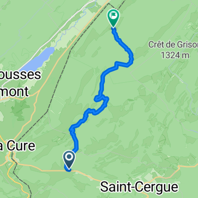
Overview
About this route
Un autre marathon VTT pour les longues journées d'été, au départ de la Givrine (montée en train), combinant plusieurs sections de parcours officiels SuisseMobile balisés (Suisse à vélo n°50, Suisse à VTT n°3 et 995), ainsi que des liaisons sur routes à faible trafic. Solitude et silence assurés sur le Mont Risoud (ou Risoux), au coeur de l'une des plus grandes forêts d'Europe d'un seul tenant, où l'on pédale en alternance sur des chemins blancs et des sentiers parfois caillouteux ou encombrés de racines, mais néanmoins roulants. Sens inverse des aiguilles d'une montre recommandé, pour profiter de la descente sur les sentiers côté Le Sentier. Nombreux refuges forestiers en très bon état pour le cas où l'orage se déchaînerait sur le Mont Risoud. Retour Le Sentier-Marchairuz-La Dunanche sur Jura Bike, car on ne s'en lasse pas. En cas de fatigue, il n'y a alors qu'à se laisser descendre jusqu'à la gare de Nyon - sinon le retour jusqu'à Genève est agréable et partiellement forestier, mais il faut compter un peu plus de 40 km depuis La Dunanche.
Distance : 134 km
Dénivelé positif : 1400 m
Altitude maximale : 1449 m (Col du Marchairuz)
Plus d'informations sur www.europebybike.info
- -:--
- Duration
- 130.8 km
- Distance
- 951 m
- Ascent
- 1,782 m
- Descent
- ---
- Avg. speed
- ---
- Max. altitude

Route quality
Waytypes & surfaces along the route
Waytypes
Track
51 km
(39 %)
Quiet road
38.5 km
(29 %)
Surfaces
Paved
63.8 km
(49 %)
Unpaved
29.7 km
(23 %)
Asphalt
47.5 km
(36 %)
Gravel
16.3 km
(12 %)
Route highlights
Points of interest along the route
Point of interest after 22.7 km
Les chamois du Panoz :-)
Drinking water after 60.7 km
Fontaine
Drinking water after 71.7 km
Fontaine au fond de la terrasse du restaurant
Continue with Bikemap
Use, edit, or download this cycling route
You would like to ride Grand Risoud Bike + Jura Bike or customize it for your own trip? Here is what you can do with this Bikemap route:
Free features
- Save this route as favorite or in collections
- Copy & plan your own version of this route
- Split it into stages to create a multi-day tour
- Sync your route with Garmin or Wahoo
Premium features
Free trial for 3 days, or one-time payment. More about Bikemap Premium.
- Navigate this route on iOS & Android
- Export a GPX / KML file of this route
- Create your custom printout (try it for free)
- Download this route for offline navigation
Discover more Premium features.
Get Bikemap PremiumFrom our community
Other popular routes starting in Saint-Cergue
 France Ultime : Belfort - Les Rousses
- Distance
- 214.3 km
- Ascent
- 1,500 m
- Descent
- 2,208 m
- Location
- Saint-Cergue, Canton of Vaud, Switzerland
 St Cergue - Grutli - Les Fruitieres de Nyon
- Distance
- 24.8 km
- Ascent
- 653 m
- Descent
- 610 m
- Location
- Saint-Cergue, Canton of Vaud, Switzerland
 JuraTotal
- Distance
- 243 km
- Ascent
- 1,967 m
- Descent
- 2,465 m
- Location
- Saint-Cergue, Canton of Vaud, Switzerland
 Crossing borders, Gex, Geneve Switzerland, France
- Distance
- 48.1 km
- Ascent
- 751 m
- Descent
- 1,546 m
- Location
- Saint-Cergue, Canton of Vaud, Switzerland
 Bourg-en-Bresse - Les Rousses
- Distance
- 179 km
- Ascent
- 1,894 m
- Descent
- 2,728 m
- Location
- Saint-Cergue, Canton of Vaud, Switzerland
 2020 - Gorets - J3 - P1
- Distance
- 11.9 km
- Ascent
- 459 m
- Descent
- 366 m
- Location
- Saint-Cergue, Canton of Vaud, Switzerland
 Jura2011(B): Col de la Givrine bis Goumois
- Distance
- 191.2 km
- Ascent
- 1,351 m
- Descent
- 2,062 m
- Location
- Saint-Cergue, Canton of Vaud, Switzerland
 retour st cergues le Muids Nyon
- Distance
- 19.9 km
- Ascent
- 50 m
- Descent
- 707 m
- Location
- Saint-Cergue, Canton of Vaud, Switzerland
Open it in the app