

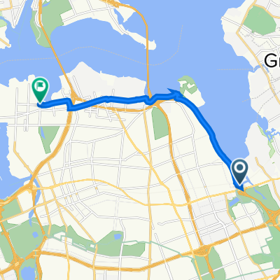
Northern Queens Waterfront Route
A cycling route starting in East Atlantic Beach, New York, United States.
Overview
About this route
08-01-2020
- -:--
- Duration
- 43.6 km
- Distance
- 153 m
- Ascent
- 171 m
- Descent
- ---
- Avg. speed
- 26 m
- Max. altitude
Route quality
Waytypes & surfaces along the route
Waytypes
Cycleway
12.6 km
(29 %)
Quiet road
11.8 km
(27 %)
Surfaces
Paved
17 km
(39 %)
Unpaved
0.4 km
(1 %)
Asphalt
17 km
(39 %)
Gravel
0.4 km
(1 %)
Undefined
26.1 km
(60 %)
Route highlights
Points of interest along the route
Point of interest after 7 km
Checkpoint #3 Little Bay Park
Point of interest after 8.7 km
Checkpoint #4 Whitetone Mall
Point of interest after 11.3 km
Checkpoint #5 Francis Lewis Park
Point of interest after 13.1 km
Checkpoint #6 Powell's Cove Park
Point of interest after 16.1 km
Checkpoint #7 Hermon A. MacNeil Park
Point of interest after 28.9 km
Checkpoint #1 Joe Michaels Mile
Point of interest after 36.6 km
Checkpoint #2 Fort Totten
Continue with Bikemap
Use, edit, or download this cycling route
You would like to ride Northern Queens Waterfront Route or customize it for your own trip? Here is what you can do with this Bikemap route:
Free features
- Save this route as favorite or in collections
- Copy & plan your own version of this route
- Sync your route with Garmin or Wahoo
Premium features
Free trial for 3 days, or one-time payment. More about Bikemap Premium.
- Navigate this route on iOS & Android
- Export a GPX / KML file of this route
- Create your custom printout (try it for free)
- Download this route for offline navigation
Discover more Premium features.
Get Bikemap PremiumFrom our community
Other popular routes starting in East Atlantic Beach
 Northern Queens Waterfront Route
- Distance
- 43.6 km
- Ascent
- 153 m
- Descent
- 171 m
- Location
- East Atlantic Beach, New York, United States
 Ride around neighborhood
- Distance
- 19.5 km
- Ascent
- 101 m
- Descent
- 101 m
- Location
- East Atlantic Beach, New York, United States
 ride through New York
- Distance
- 12.6 km
- Ascent
- 65 m
- Descent
- 59 m
- Location
- East Atlantic Beach, New York, United States
 169-32 23rd Ave, New York to 169-28 23rd Ave, New York
- Distance
- 15.4 km
- Ascent
- 0 m
- Descent
- 25 m
- Location
- East Atlantic Beach, New York, United States
 17th Rd, New York to Lafayette St, New York
- Distance
- 21.8 km
- Ascent
- 234 m
- Descent
- 245 m
- Location
- East Atlantic Beach, New York, United States
 Cross Island Pkwy N, New York to 132-01 11th Ave, New York
- Distance
- 9.4 km
- Ascent
- 3 m
- Descent
- 3 m
- Location
- East Atlantic Beach, New York, United States
 Ride around the neighborhood
- Distance
- 23.9 km
- Ascent
- 108 m
- Descent
- 109 m
- Location
- East Atlantic Beach, New York, United States
 To Dembowski Bellerose
- Distance
- 12 km
- Ascent
- 84 m
- Descent
- 74 m
- Location
- East Atlantic Beach, New York, United States
Open it in the app