

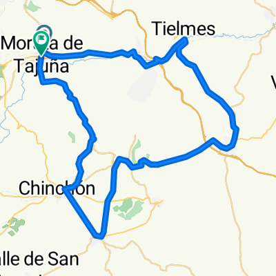
V. V. Morata de Tajuña - Perales de Tajuña - Tielmes - Carabaña - Orusco - Ambite
A cycling route starting in Morata de Tajuña, Madrid, Spain.
Overview
About this route
Una ruta preciosa, divertida, facil de seguir, bien señalizada. Recomendable hacerla en primavera. En general de dificultad facil, pero con algunas cuestas moderadas. ¡¡ Os animo a hacerla !!
- 4 h 48 min
- Duration
- 62.5 km
- Distance
- 275 m
- Ascent
- 261 m
- Descent
- 13 km/h
- Avg. speed
- ---
- Max. altitude
Route quality
Waytypes & surfaces along the route
Waytypes
Cycleway
54.4 km
(87 %)
Quiet road
3.7 km
(6 %)
Surfaces
Paved
60 km
(96 %)
Paved (undefined)
59.4 km
(95 %)
Asphalt
0.6 km
(1 %)
Undefined
2.5 km
(4 %)
Continue with Bikemap
Use, edit, or download this cycling route
You would like to ride V. V. Morata de Tajuña - Perales de Tajuña - Tielmes - Carabaña - Orusco - Ambite or customize it for your own trip? Here is what you can do with this Bikemap route:
Free features
- Save this route as favorite or in collections
- Copy & plan your own version of this route
- Sync your route with Garmin or Wahoo
Premium features
Free trial for 3 days, or one-time payment. More about Bikemap Premium.
- Navigate this route on iOS & Android
- Export a GPX / KML file of this route
- Create your custom printout (try it for free)
- Download this route for offline navigation
Discover more Premium features.
Get Bikemap PremiumFrom our community
Other popular routes starting in Morata de Tajuña
 Morata de Tajuña
- Distance
- 36.4 km
- Ascent
- 403 m
- Descent
- 440 m
- Location
- Morata de Tajuña, Madrid, Spain
 Route 11 Madrid to Barcelona Route
- Distance
- 725 km
- Ascent
- 2,496 m
- Descent
- 3,116 m
- Location
- Morata de Tajuña, Madrid, Spain
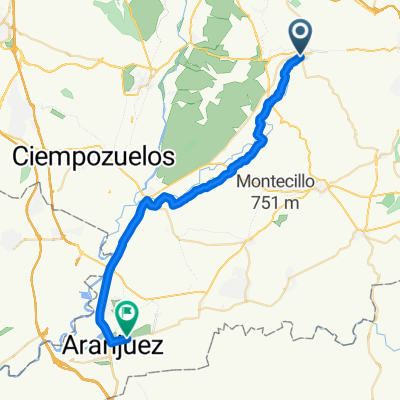 Morata-Aranjuez
- Distance
- 32.8 km
- Ascent
- 63 m
- Descent
- 106 m
- Location
- Morata de Tajuña, Madrid, Spain
 De Calle del Carmen, Morata de Tajuña a M-313, Morata de Tajuña
- Distance
- 26 km
- Ascent
- 366 m
- Descent
- 368 m
- Location
- Morata de Tajuña, Madrid, Spain
 entrenamiento de fondo
- Distance
- 202.9 km
- Ascent
- 1,462 m
- Descent
- 1,399 m
- Location
- Morata de Tajuña, Madrid, Spain
 Camino Estacà
- Distance
- 14.3 km
- Ascent
- 139 m
- Descent
- 138 m
- Location
- Morata de Tajuña, Madrid, Spain
 Morata, Villarejo,Colmenar de Oreja
- Distance
- 57.8 km
- Ascent
- 3,087 m
- Descent
- 3,117 m
- Location
- Morata de Tajuña, Madrid, Spain
 Morata de Tajuña - Ambite - Morata de Tajuña
- Distance
- 64.7 km
- Ascent
- 150 m
- Descent
- 151 m
- Location
- Morata de Tajuña, Madrid, Spain
Open it in the app