

Ein freier Tag...
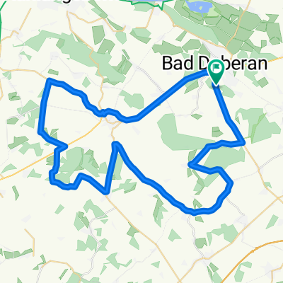
A cycling route starting in Bad Doberan, Mecklenburg-Vorpommern, Germany.
Overview
About this route
Asphaltstrassen, Radwege, teilweise Plattenstr.- aber recht ordentlich.
- -:--
- Duration
- 93.5 km
- Distance
- 255 m
- Ascent
- 255 m
- Descent
- ---
- Avg. speed
- ---
- Max. altitude

Route quality
Waytypes & surfaces along the route
Waytypes
Quiet road
37.8 km
(40 %)
Busy road
27.7 km
(30 %)
Surfaces
Paved
66.8 km
(71 %)
Unpaved
0 km
(<1 %)
Asphalt
52.1 km
(56 %)
Paving stones
12.8 km
(14 %)
Continue with Bikemap
Use, edit, or download this cycling route
You would like to ride Ein freier Tag... or customize it for your own trip? Here is what you can do with this Bikemap route:
Free features
- Save this route as favorite or in collections
- Copy & plan your own version of this route
- Split it into stages to create a multi-day tour
- Sync your route with Garmin or Wahoo
Premium features
Free trial for 3 days, or one-time payment. More about Bikemap Premium.
- Navigate this route on iOS & Android
- Export a GPX / KML file of this route
- Create your custom printout (try it for free)
- Download this route for offline navigation
Discover more Premium features.
Get Bikemap PremiumFrom our community
Other popular routes starting in Bad Doberan
 Bad Doberan-A20-Stäbelow-Bargeshagen-Elmenhorst-Nienhagen-Steinbeck-Rethwisch-Heiligendamm-Bad Doberan
- Distance
- 58.7 km
- Ascent
- 127 m
- Descent
- 175 m
- Location
- Bad Doberan, Mecklenburg-Vorpommern, Germany
 2h - Bad Doberan - Börgerende - Heiligendamm - Bad Doberan
- Distance
- 19.5 km
- Ascent
- 64 m
- Descent
- 64 m
- Location
- Bad Doberan, Mecklenburg-Vorpommern, Germany
 Hanze Bad Doberan - Rostock
- Distance
- 32.5 km
- Ascent
- 88 m
- Descent
- 101 m
- Location
- Bad Doberan, Mecklenburg-Vorpommern, Germany
 16-07-05_Bad Doberan-Kühlungsborn
- Distance
- 16.4 km
- Ascent
- 59 m
- Descent
- 70 m
- Location
- Bad Doberan, Mecklenburg-Vorpommern, Germany
 Gerade Fahrt in Bad Doberan
- Distance
- 18.5 km
- Ascent
- 0 m
- Descent
- 9 m
- Location
- Bad Doberan, Mecklenburg-Vorpommern, Germany
 Ausfahrt zur neuen Kreisstadt Güstrow
- Distance
- 98.9 km
- Ascent
- 298 m
- Descent
- 298 m
- Location
- Bad Doberan, Mecklenburg-Vorpommern, Germany
 Ruhige Runde im alten Landkreis
- Distance
- 53.7 km
- Ascent
- 216 m
- Descent
- 216 m
- Location
- Bad Doberan, Mecklenburg-Vorpommern, Germany
 Ein freier Tag...
- Distance
- 93.5 km
- Ascent
- 255 m
- Descent
- 255 m
- Location
- Bad Doberan, Mecklenburg-Vorpommern, Germany
Open it in the app