

Wild Atlantic Way Route
A cycling route starting in Kenmare, Munster, Ireland.
Overview
About this route
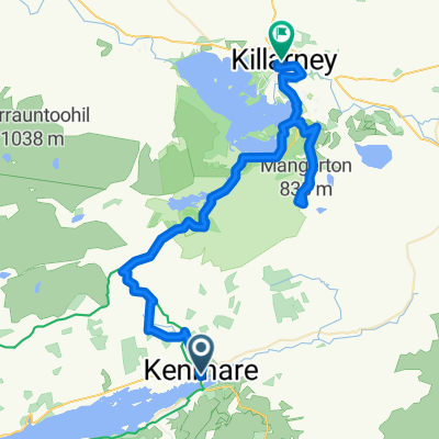
Kenmare to Galway
- -:--
- Duration
- 524.8 km
- Distance
- 1,177 m
- Ascent
- 1,183 m
- Descent
- ---
- Avg. speed
- ---
- Max. altitude

Continue with Bikemap
Use, edit, or download this cycling route
You would like to ride Wild Atlantic Way Route or customize it for your own trip? Here is what you can do with this Bikemap route:
Free features
- Save this route as favorite or in collections
- Copy & plan your own version of this route
- Split it into stages to create a multi-day tour
- Sync your route with Garmin or Wahoo
Premium features
Free trial for 3 days, or one-time payment. More about Bikemap Premium.
- Navigate this route on iOS & Android
- Export a GPX / KML file of this route
- Create your custom printout (try it for free)
- Download this route for offline navigation
Discover more Premium features.
Get Bikemap PremiumFrom our community
Other popular routes starting in Kenmare
 Ire1_Etp16 Tahilla-Eyeries
- Distance
- 60.8 km
- Ascent
- 477 m
- Descent
- 478 m
- Location
- Kenmare, Munster, Ireland
 La península de Iveragh
- Distance
- 127.4 km
- Ascent
- 991 m
- Descent
- 991 m
- Location
- Kenmare, Munster, Ireland
 From Kenmare to Killarney
- Distance
- 54.4 km
- Ascent
- 1,305 m
- Descent
- 1,287 m
- Location
- Kenmare, Munster, Ireland
 Irland Tour 3+4 - Ring of Kerry
- Distance
- 139.6 km
- Ascent
- 644 m
- Descent
- 623 m
- Location
- Kenmare, Munster, Ireland
 2020 Ireland Cycle: Day 1
- Distance
- 61.5 km
- Ascent
- 445 m
- Descent
- 449 m
- Location
- Kenmare, Munster, Ireland
 Irland 2007 - Tag 2 (Kenmare - Bantry)
- Distance
- 34.7 km
- Ascent
- 544 m
- Descent
- 536 m
- Location
- Kenmare, Munster, Ireland
 Wild Atlantic Way Route
- Distance
- 524.8 km
- Ascent
- 1,177 m
- Descent
- 1,183 m
- Location
- Kenmare, Munster, Ireland
 MOLL'S GAP, por Kenmare
- Distance
- 9.1 km
- Ascent
- 281 m
- Descent
- 51 m
- Location
- Kenmare, Munster, Ireland
Open it in the app