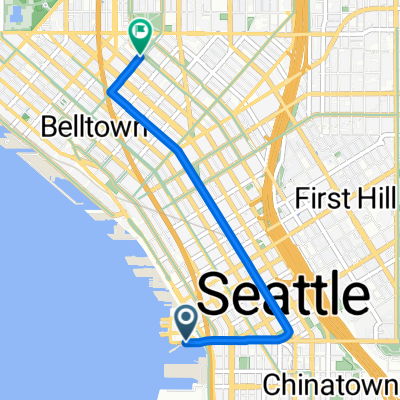
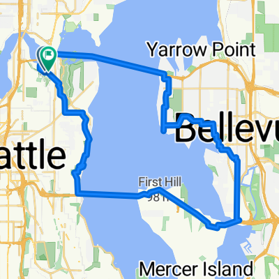
FREMONT - INTERURBAN - EDMONDS
A cycling route starting in Seattle, Washington, United States of America.
Overview
About this route
Head up north! This takes you on some bike lanes, a segment of the Interurban rail-to-trail separated bike path before veering off to head out to Edmonds. If you are feeling especially adventurous (and have some time), catch a ferry to Kingston and ride out onto the Olympic Peninsula.
- -:--
- Duration
- 22.3 km
- Distance
- 264 m
- Ascent
- 275 m
- Descent
- ---
- Avg. speed
- ---
- Avg. speed
Route quality
Waytypes & surfaces along the route
Waytypes
Road
12.9 km
(58 %)
Quiet road
4.7 km
(21 %)
Surfaces
Paved
14.6 km
(66 %)
Asphalt
14 km
(63 %)
Concrete
0.7 km
(3 %)
Undefined
7.7 km
(34 %)
Continue with Bikemap
Use, edit, or download this cycling route
You would like to ride FREMONT - INTERURBAN - EDMONDS or customize it for your own trip? Here is what you can do with this Bikemap route:
Free features
- Save this route as favorite or in collections
- Copy & plan your own version of this route
- Sync your route with Garmin or Wahoo
Premium features
Free trial for 3 days, or one-time payment. More about Bikemap Premium.
- Navigate this route on iOS & Android
- Export a GPX / KML file of this route
- Create your custom printout (try it for free)
- Download this route for offline navigation
Discover more Premium features.
Get Bikemap PremiumFrom our community
Other popular routes starting in Seattle
- Bridge2Bridge
- Distance
- 34.3 km
- Ascent
- 448 m
- Descent
- 449 m
- Location
- Seattle, Washington, United States of America
- Southern Lake Washington Loop
- Distance
- 58.2 km
- Ascent
- 357 m
- Descent
- 358 m
- Location
- Seattle, Washington, United States of America
- Fremont - Kenmore - Kirkland - 520 - Fremont Loop
- Distance
- 49.1 km
- Ascent
- 568 m
- Descent
- 568 m
- Location
- Seattle, Washington, United States of America
- Snoqualmie Loop
- Distance
- 117 km
- Ascent
- 824 m
- Descent
- 824 m
- Location
- Seattle, Washington, United States of America
- 1403 Lake Washington Blvd S, Seattle to 1501 Lake Washington Blvd S, Seattle
- Distance
- 72.3 km
- Ascent
- 717 m
- Descent
- 728 m
- Location
- Seattle, Washington, United States of America
- Magnolia/Discovery Park Hidden Areas and Great Climbs
- Distance
- 34.9 km
- Ascent
- 530 m
- Descent
- 530 m
- Location
- Seattle, Washington, United States of America
- 2802 NW 61st St, Seattle to 2811 NW 61st St, Seattle
- Distance
- 61.5 km
- Ascent
- 6 m
- Descent
- 35 m
- Location
- Seattle, Washington, United States of America
- Stop by work then get beer and drink beer in park loop
- Distance
- 29.3 km
- Ascent
- 294 m
- Descent
- 295 m
- Location
- Seattle, Washington, United States of America
Open it in the app