

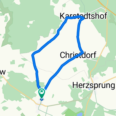
Langnow - Kattenstieg - Neustadt
A cycling route starting in Heiligengrabe, Brandenburg, Germany.
Overview
About this route
Nice route, low traffic, partially exclusive bike paths
- -:--
- Duration
- 45.9 km
- Distance
- 125 m
- Ascent
- 167 m
- Descent
- ---
- Avg. speed
- ---
- Max. altitude
Route quality
Waytypes & surfaces along the route
Waytypes
Road
16.5 km
(36 %)
Quiet road
11.9 km
(26 %)
Surfaces
Paved
22.9 km
(50 %)
Unpaved
1.8 km
(4 %)
Asphalt
16.1 km
(35 %)
Concrete
6.4 km
(14 %)
Continue with Bikemap
Use, edit, or download this cycling route
You would like to ride Langnow - Kattenstieg - Neustadt or customize it for your own trip? Here is what you can do with this Bikemap route:
Free features
- Save this route as favorite or in collections
- Copy & plan your own version of this route
- Sync your route with Garmin or Wahoo
Premium features
Free trial for 3 days, or one-time payment. More about Bikemap Premium.
- Navigate this route on iOS & Android
- Export a GPX / KML file of this route
- Create your custom printout (try it for free)
- Download this route for offline navigation
Discover more Premium features.
Get Bikemap PremiumFrom our community
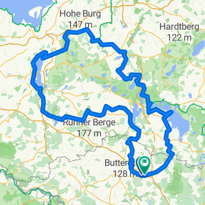
Other popular routes starting in Heiligengrabe
 Königsberger Dorfstraße 27, Heiligengrabe nach Königsberger Dorfstraße 27, Heiligengrabe
- Distance
- 11.1 km
- Ascent
- 72 m
- Descent
- 70 m
- Location
- Heiligengrabe, Brandenburg, Germany
 26-MRZ-21 15:01:12
- Distance
- 17.8 km
- Ascent
- 112 m
- Descent
- 113 m
- Location
- Heiligengrabe, Brandenburg, Germany
 Relaxed route in Heiligengrabe
- Distance
- 15.4 km
- Ascent
- 45 m
- Descent
- 35 m
- Location
- Heiligengrabe, Brandenburg, Germany
 Liebenthaler Dorfstraße 60, Heiligengrabe nach Sewekower Dorfstraße 4, Wittstock/Dosse
- Distance
- 27 km
- Ascent
- 151 m
- Descent
- 159 m
- Location
- Heiligengrabe, Brandenburg, Germany
 Route nach Heiligengrabe
- Distance
- 404.2 km
- Ascent
- 2,019 m
- Descent
- 2,026 m
- Location
- Heiligengrabe, Brandenburg, Germany
 Wanderweg Heiligengrabe
- Distance
- 16.9 km
- Ascent
- 105 m
- Descent
- 107 m
- Location
- Heiligengrabe, Brandenburg, Germany
 Tour 1
- Distance
- 125.9 km
- Ascent
- 287 m
- Descent
- 289 m
- Location
- Heiligengrabe, Brandenburg, Germany
 Route nach Heiligengrabe
- Distance
- 31.4 km
- Ascent
- 24 m
- Descent
- 24 m
- Location
- Heiligengrabe, Brandenburg, Germany
Open it in the app