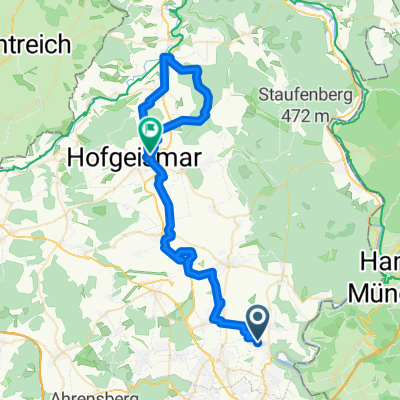
Rundfahrt über Sababurg
A cycling route starting in Vellmar, Hesse, Germany.
Overview
About this route
The route is fairly easy to ride, except for a few longer climbs in the forest that can be a bit challenging due to the gravel. The loop is well suited for mountain bikes and trekking bikes. In terms of time, you should plan for 4 to 4.5 hours. The loop is partly based on the track of the Reinhardswaldradweg, but it does not always match the signage, so this route was created.
- -:--
- Duration
- 74.4 km
- Distance
- 764 m
- Ascent
- 743 m
- Descent
- ---
- Avg. speed
- 390 m
- Max. altitude
Route quality
Waytypes & surfaces along the route
Waytypes
Track
37.9 km
(51 %)
Quiet road
14.1 km
(19 %)
Surfaces
Paved
49.1 km
(66 %)
Unpaved
18.6 km
(25 %)
Asphalt
46.1 km
(62 %)
Gravel
12.6 km
(17 %)
Continue with Bikemap
Use, edit, or download this cycling route
You would like to ride Rundfahrt über Sababurg or customize it for your own trip? Here is what you can do with this Bikemap route:
Free features
- Save this route as favorite or in collections
- Copy & plan your own version of this route
- Sync your route with Garmin or Wahoo
Premium features
Free trial for 3 days, or one-time payment. More about Bikemap Premium.
- Navigate this route on iOS & Android
- Export a GPX / KML file of this route
- Create your custom printout (try it for free)
- Download this route for offline navigation
Discover more Premium features.
Get Bikemap PremiumFrom our community
Other popular routes starting in Vellmar
- Rundfahrt über Sababurg
- Distance
- 74.4 km
- Ascent
- 764 m
- Descent
- 743 m
- Location
- Vellmar, Hesse, Germany
- Entdecker-Runde Kassel
- Distance
- 48.3 km
- Ascent
- 371 m
- Descent
- 369 m
- Location
- Vellmar, Hesse, Germany
- Entlang der Fulda
- Distance
- 33.5 km
- Ascent
- 142 m
- Descent
- 142 m
- Location
- Vellmar, Hesse, Germany
- kurze, anspruchsvolle Strecke über den Dörnberg
- Distance
- 32.7 km
- Ascent
- 424 m
- Descent
- 418 m
- Location
- Vellmar, Hesse, Germany
- wellige Tour über Breuna, Escheberg, Zierenberg
- Distance
- 57.8 km
- Ascent
- 618 m
- Descent
- 622 m
- Location
- Vellmar, Hesse, Germany
- Habichtswald
- Distance
- 47.4 km
- Ascent
- 858 m
- Descent
- 858 m
- Location
- Vellmar, Hesse, Germany
- von KS nach Trendelburg u. Bad Karlshafen nach Hann Münden
- Distance
- 119.5 km
- Ascent
- 421 m
- Descent
- 421 m
- Location
- Vellmar, Hesse, Germany
- Simmershausen - Hohenkirchen - Calden - Immenhausen - Simmershausen
- Distance
- 34 km
- Ascent
- 256 m
- Descent
- 192 m
- Location
- Vellmar, Hesse, Germany
Open it in the app