

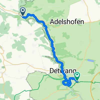
2010-Tag14: Holdermühle-Steinbachtal und zurück
A cycling route starting in Adelshofen, Bavaria, Germany.
Overview
About this route
Rainy day
Excursion to the Steinbach Valley, a wonderful little piece of wilderness
- -:--
- Duration
- 23.5 km
- Distance
- 172 m
- Ascent
- 169 m
- Descent
- ---
- Avg. speed
- ---
- Max. altitude
Route quality
Waytypes & surfaces along the route
Waytypes
Track
17.2 km
(73 %)
Quiet road
1.9 km
(8 %)
Surfaces
Paved
16 km
(68 %)
Unpaved
7.1 km
(30 %)
Asphalt
15.8 km
(67 %)
Unpaved (undefined)
5.7 km
(24 %)
Route highlights
Points of interest along the route
Point of interest after 11.6 km
Schützenhaus - Pause im Regen
Point of interest after 17.5 km
Kaffeepause in der alten Schreinerei
Continue with Bikemap
Use, edit, or download this cycling route
You would like to ride 2010-Tag14: Holdermühle-Steinbachtal und zurück or customize it for your own trip? Here is what you can do with this Bikemap route:
Free features
- Save this route as favorite or in collections
- Copy & plan your own version of this route
- Sync your route with Garmin or Wahoo
Premium features
Free trial for 3 days, or one-time payment. More about Bikemap Premium.
- Navigate this route on iOS & Android
- Export a GPX / KML file of this route
- Create your custom printout (try it for free)
- Download this route for offline navigation
Discover more Premium features.
Get Bikemap PremiumFrom our community
Other popular routes starting in Adelshofen
 Feierabendrunde
- Distance
- 45.5 km
- Ascent
- 287 m
- Descent
- 287 m
- Location
- Adelshofen, Bavaria, Germany
 2010-Tag14: Holdermühle-Steinbachtal und zurück
- Distance
- 23.5 km
- Ascent
- 172 m
- Descent
- 169 m
- Location
- Adelshofen, Bavaria, Germany
 Hessentour 2006 5.6. Tag03
- Distance
- 115.9 km
- Ascent
- 0 m
- Descent
- 0 m
- Location
- Adelshofen, Bavaria, Germany
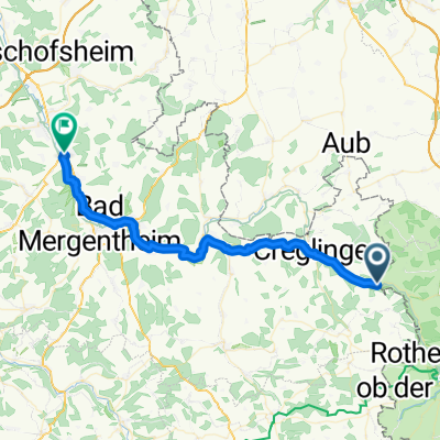
 2010-Tag15(Teil1): Tauberzell/Holdermühle-Rothenburg op der Tauber
- Distance
- 16.3 km
- Ascent
- 288 m
- Descent
- 158 m
- Location
- Adelshofen, Bavaria, Germany
 Petersberg Bahn Burgbernheim
- Distance
- 45.4 km
- Ascent
- 342 m
- Descent
- 342 m
- Location
- Adelshofen, Bavaria, Germany
 Aischtalradweg von Forchheim zu Holdermühle
- Distance
- 105.4 km
- Ascent
- 252 m
- Descent
- 279 m
- Location
- Adelshofen, Bavaria, Germany
 2017 Holdermühle/Tauber--Gern/Altmühl
- Distance
- 70.6 km
- Ascent
- 312 m
- Descent
- 190 m
- Location
- Adelshofen, Bavaria, Germany
 Radltour2015_Etappe3
- Distance
- 38.4 km
- Ascent
- 279 m
- Descent
- 383 m
- Location
- Adelshofen, Bavaria, Germany
Open it in the app