

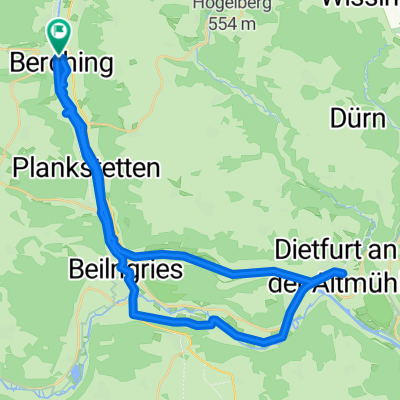
2010-Tag17: Berching-Kelheim
A cycling route starting in Berching, Bavaria, Germany.
Overview
About this route
along the Altmühl and the Rhine-Main-Danube Canal
Weather improved
On-site shopping tour
- -:--
- Duration
- 65.1 km
- Distance
- 84 m
- Ascent
- 132 m
- Descent
- ---
- Avg. speed
- ---
- Max. altitude
Route quality
Waytypes & surfaces along the route
Waytypes
Track
35.2 km
(54 %)
Quiet road
15 km
(23 %)
Surfaces
Paved
30 km
(46 %)
Unpaved
30 km
(46 %)
Asphalt
30 km
(46 %)
Gravel
19.5 km
(30 %)
Route highlights
Points of interest along the route
Point of interest after 8.9 km
der verwettete Kaffee wurde eingelöst, eine Regenzwangspause
Point of interest after 27.2 km
Mittagspause - mittlerweile gibt es hier ein Radlerunterstand - wieder Regen
Point of interest after 37.8 km
teure Kaffeepause im Regen
Point of interest after 47 km
längste Holzhängebrücke Europas
Point of interest after 55.7 km
Touristinfo
Point of interest after 55.8 km
Suppenpause
Accommodation after 60.2 km
günstige Übernachtung
Point of interest after 63 km
Einkaufen
Continue with Bikemap
Use, edit, or download this cycling route
You would like to ride 2010-Tag17: Berching-Kelheim or customize it for your own trip? Here is what you can do with this Bikemap route:
Free features
- Save this route as favorite or in collections
- Copy & plan your own version of this route
- Sync your route with Garmin or Wahoo
Premium features
Free trial for 3 days, or one-time payment. More about Bikemap Premium.
- Navigate this route on iOS & Android
- Export a GPX / KML file of this route
- Create your custom printout (try it for free)
- Download this route for offline navigation
Discover more Premium features.
Get Bikemap PremiumFrom our community
Other popular routes starting in Berching
 2017 Plankstetten Kloster-Weltenburg Kloster
- Distance
- 55.5 km
- Ascent
- 55 m
- Descent
- 115 m
- Location
- Berching, Bavaria, Germany
 2012 - 2. Tag - Berching-Lindkirchen
- Distance
- 86 km
- Ascent
- 264 m
- Descent
- 243 m
- Location
- Berching, Bavaria, Germany
 Winterzhoferer Berg - Oening
- Distance
- 19 km
- Ascent
- 196 m
- Descent
- 196 m
- Location
- Berching, Bavaria, Germany
 Kel.2 Gösseltal um Sulzburg u. zurück
- Distance
- 46.4 km
- Ascent
- 135 m
- Descent
- 134 m
- Location
- Berching, Bavaria, Germany
 17.07.06 Berching-Feucht
- Distance
- 55.4 km
- Ascent
- 167 m
- Descent
- 201 m
- Location
- Berching, Bavaria, Germany
 Berching,Beilngries,Dietfurt und retour
- Distance
- 39.2 km
- Ascent
- 56 m
- Descent
- 58 m
- Location
- Berching, Bavaria, Germany
 Triathlon Beilingries Laufrunde
- Distance
- 4.2 km
- Ascent
- 0 m
- Descent
- 0 m
- Location
- Berching, Bavaria, Germany
 Berching W Steinweg Nr. 1
- Distance
- 8.5 km
- Ascent
- 191 m
- Descent
- 193 m
- Location
- Berching, Bavaria, Germany
Open it in the app