2010-Tag22: Antygl-Stozec
- 60.4 km
- 484 m
- 635 m
- Kašperské Hory, Plzeň Region, Czechia
continue riding the beautiful Czech cycling network with a detour to Germany long descent, wonderfully along the warm Vltava highest point of the journey surpassed, 1153m says the program here
Road
14.5 km24 %Quiet road
14.5 km24 %Paved
32 km(53 %)Unpaved
4.2 km(7 %)Asphalt
29 km48 %Paved (undefined)
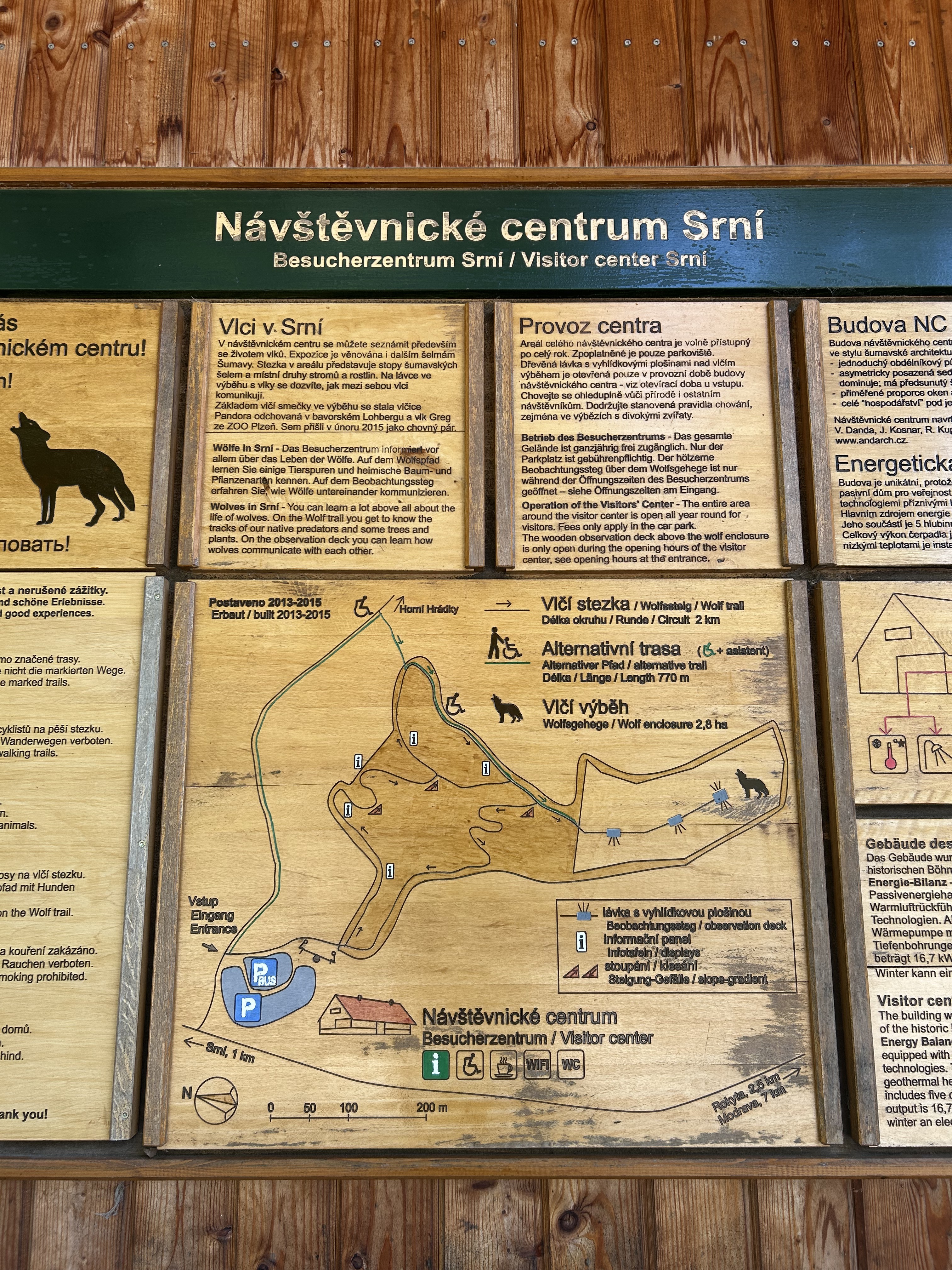
3 km5 %Viele Infos zum Nationalpark - superinteressant
die warme Moldau
Essenspause
Trinkpause
Bank - Geld holen
Supermarkt und Kaffeepause und eine dumme Wette, die ich verloren hab
Geld gewechselt
2 Übernachtungen in pension pstruh
Supermarkt
Free trial for 3 days, or one-time payment. More about Bikemap Premium.
Discover more Premium features.
Get Bikemap PremiumOpen it in the app