

2010 Furtmühle Ausflug
A cycling route starting in Schlägl, Upper Austria, Austria.
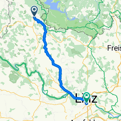
Overview
About this route
a small trip around Furtmühle to the chapel and for swimming and hanging out at the Great Mühl
on the last summer day of 2010
- -:--
- Duration
- 6.7 km
- Distance
- 106 m
- Ascent
- 110 m
- Descent
- ---
- Avg. speed
- ---
- Max. altitude
Route highlights
Points of interest along the route
Point of interest after 5 km
Kapelski und Hängemattenpause
Continue with Bikemap
Use, edit, or download this cycling route
You would like to ride 2010 Furtmühle Ausflug or customize it for your own trip? Here is what you can do with this Bikemap route:
Free features
- Save this route as favorite or in collections
- Copy & plan your own version of this route
- Sync your route with Garmin or Wahoo
Premium features
Free trial for 3 days, or one-time payment. More about Bikemap Premium.
- Navigate this route on iOS & Android
- Export a GPX / KML file of this route
- Create your custom printout (try it for free)
- Download this route for offline navigation
Discover more Premium features.
Get Bikemap PremiumFrom our community
Other popular routes starting in Schlägl
 Ameisbergrunde
- Distance
- 44.5 km
- Ascent
- 1,029 m
- Descent
- 1,027 m
- Location
- Schlägl, Upper Austria, Austria
 Haslach/Svaty Tomas/Stausee/Afiesl/Haslach
- Distance
- 45.9 km
- Ascent
- 0 m
- Descent
- 0 m
- Location
- Schlägl, Upper Austria, Austria
 Lipno Stausse Runde oben
- Distance
- 77 km
- Ascent
- 1,247 m
- Descent
- 1,245 m
- Location
- Schlägl, Upper Austria, Austria
 Rohrbach nach Wien 2017
- Distance
- 264.6 km
- Ascent
- 151 m
- Descent
- 555 m
- Location
- Schlägl, Upper Austria, Austria
 Rohrbach-Berg - Nove Udolí
- Distance
- 57 km
- Ascent
- 737 m
- Descent
- 513 m
- Location
- Schlägl, Upper Austria, Austria
 Grüner Weg, Aigen-Schlägl nach Bahnhofplatz, Linz
- Distance
- 59.5 km
- Ascent
- 804 m
- Descent
- 1,110 m
- Location
- Schlägl, Upper Austria, Austria
 2010 St Oswald/Furtmühle-Passau
- Distance
- 80.6 km
- Ascent
- 389 m
- Descent
- 603 m
- Location
- Schlägl, Upper Austria, Austria
 2010 Furtmühle Ausflug
- Distance
- 6.7 km
- Ascent
- 106 m
- Descent
- 110 m
- Location
- Schlägl, Upper Austria, Austria
Open it in the app