

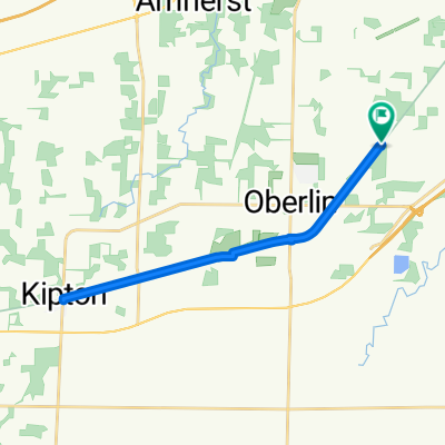
Oberlin Bike Path, Oberlin to 87 E Lorain St, Oberlin
A cycling route starting in Oberlin, Ohio, United States.
Overview
About this route
- 42 min
- Duration
- 14.8 km
- Distance
- 60 m
- Ascent
- 63 m
- Descent
- 21 km/h
- Avg. speed
- ---
- Max. altitude

Route quality
Waytypes & surfaces along the route
Waytypes
Cycleway
12.1 km
(82 %)
Quiet road
2.5 km
(17 %)
Undefined
0.1 km
(1 %)
Surfaces
Paved
14.8 km
(100 %)
Asphalt
14.8 km
(100 %)
Continue with Bikemap
Use, edit, or download this cycling route
You would like to ride Oberlin Bike Path, Oberlin to 87 E Lorain St, Oberlin or customize it for your own trip? Here is what you can do with this Bikemap route:
Free features
- Save this route as favorite or in collections
- Copy & plan your own version of this route
- Sync your route with Garmin or Wahoo
Premium features
Free trial for 3 days, or one-time payment. More about Bikemap Premium.
- Navigate this route on iOS & Android
- Export a GPX / KML file of this route
- Create your custom printout (try it for free)
- Download this route for offline navigation
Discover more Premium features.
Get Bikemap PremiumFrom our community
Other popular routes starting in Oberlin
 Oberlin to Elyria South Park
- Distance
- 13.8 km
- Ascent
- 35 m
- Descent
- 54 m
- Location
- Oberlin, Ohio, United States
 240 S Main St, Oberlin to 240 S Main St, Oberlin
- Distance
- 24.4 km
- Ascent
- 70 m
- Descent
- 69 m
- Location
- Oberlin, Ohio, United States
 Recovered Route
- Distance
- 40.9 km
- Ascent
- 120 m
- Descent
- 192 m
- Location
- Oberlin, Ohio, United States
 1) North Coast Inland Trail - Butternut Ridge Trailhead to
- Distance
- 23.7 km
- Ascent
- 36 m
- Descent
- 34 m
- Location
- Oberlin, Ohio, United States
 14 Hawthorne Dr, Oberlin to 118 Dikeman Rd, Pittsford
- Distance
- 504.1 km
- Ascent
- 2,608 m
- Descent
- 2,668 m
- Location
- Oberlin, Ohio, United States
 265 S Main St, Oberlin to 265 S Main St, Oberlin
- Distance
- 16 km
- Ascent
- 32 m
- Descent
- 32 m
- Location
- Oberlin, Ohio, United States
 Oberlin Depot to Norwalk Township Recycling Center
- Distance
- 35.7 km
- Ascent
- 101 m
- Descent
- 123 m
- Location
- Oberlin, Ohio, United States
 trip to margaritaville
- Distance
- 59.9 km
- Ascent
- 213 m
- Descent
- 287 m
- Location
- Oberlin, Ohio, United States
Open it in the app