

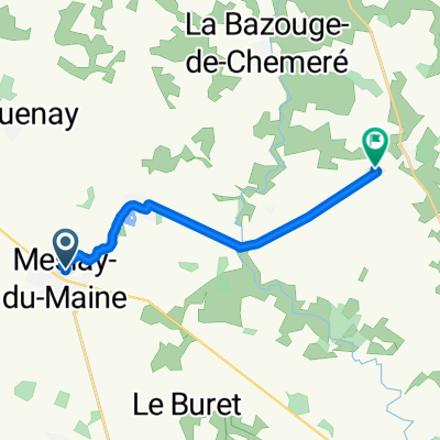
Itinéraire vers 22 Route de Laval, Azé
A cycling route starting in Meslay-du-Maine, Pays de la Loire Region, France.
Overview
About this route
- 1 h 2 min
- Duration
- 25.5 km
- Distance
- 153 m
- Ascent
- 212 m
- Descent
- 24.5 km/h
- Avg. speed
- ---
- Max. altitude
Route quality
Waytypes & surfaces along the route
Waytypes
Road
10.7 km
(42 %)
Quiet road
7.4 km
(29 %)
Surfaces
Paved
4.6 km
(18 %)
Asphalt
3.6 km
(14 %)
Paved (undefined)
1 km
(4 %)
Undefined
20.9 km
(82 %)
Continue with Bikemap
Use, edit, or download this cycling route
You would like to ride Itinéraire vers 22 Route de Laval, Azé or customize it for your own trip? Here is what you can do with this Bikemap route:
Free features
- Save this route as favorite or in collections
- Copy & plan your own version of this route
- Sync your route with Garmin or Wahoo
Premium features
Free trial for 3 days, or one-time payment. More about Bikemap Premium.
- Navigate this route on iOS & Android
- Export a GPX / KML file of this route
- Create your custom printout (try it for free)
- Download this route for offline navigation
Discover more Premium features.
Get Bikemap PremiumFrom our community
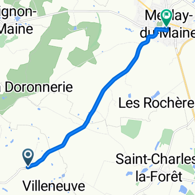
Other popular routes starting in Meslay-du-Maine
 D610, Longuefuye to D109, Ruillé-Froid-Fonds
- Distance
- 18.5 km
- Ascent
- 135 m
- Descent
- 161 m
- Location
- Meslay-du-Maine, Pays de la Loire Region, France
 Itinéraire vers 22 Route de Laval, Azé
- Distance
- 25.5 km
- Ascent
- 153 m
- Descent
- 212 m
- Location
- Meslay-du-Maine, Pays de la Loire Region, France
 D109, Ruillé-Froid-Fonds to La Lézardière, Villiers-Charlemagne
- Distance
- 7.7 km
- Ascent
- 51 m
- Descent
- 41 m
- Location
- Meslay-du-Maine, Pays de la Loire Region, France
 Rue de Laval Bis to La Transoulière
- Distance
- 10.4 km
- Ascent
- 56 m
- Descent
- 103 m
- Location
- Meslay-du-Maine, Pays de la Loire Region, France
 Saint-Denis-du-Maine-Chateau-la-Vallière
- Distance
- 86.3 km
- Ascent
- 238 m
- Descent
- 230 m
- Location
- Meslay-du-Maine, Pays de la Loire Region, France
 Le Haut Mortier to Rue Raoul du Bouchet
- Distance
- 5.8 km
- Ascent
- 50 m
- Descent
- 37 m
- Location
- Meslay-du-Maine, Pays de la Loire Region, France
Open it in the app