
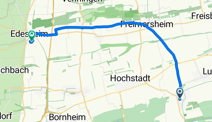
Hauptstraße 28, Zeiskam nach In den Elfmorgen, Edesheim
A cycling route starting in Zeiskam, Rhineland-Palatinate, Germany.
Overview
About this route
- 42 min
- Duration
- 12.1 km
- Distance
- 64 m
- Ascent
- 36 m
- Descent
- 17.1 km/h
- Avg. speed
- ---
- Max. altitude
Route quality
Waytypes & surfaces along the route
Waytypes
Track
5.2 km
(43 %)
Road
4.9 km
(41 %)
Surfaces
Paved
11.3 km
(94 %)
Asphalt
6.9 km
(57 %)
Concrete
2.3 km
(19 %)
Continue with Bikemap
Use, edit, or download this cycling route
You would like to ride Hauptstraße 28, Zeiskam nach In den Elfmorgen, Edesheim or customize it for your own trip? Here is what you can do with this Bikemap route:
Free features
- Save this route as favorite or in collections
- Copy & plan your own version of this route
- Sync your route with Garmin or Wahoo
Premium features
Free trial for 3 days, or one-time payment. More about Bikemap Premium.
- Navigate this route on iOS & Android
- Export a GPX / KML file of this route
- Create your custom printout (try it for free)
- Download this route for offline navigation
Discover more Premium features.
Get Bikemap PremiumFrom our community
Other popular routes starting in Zeiskam
 2020 Kalmit
- Distance
- 72.3 km
- Ascent
- 962 m
- Descent
- 960 m
- Location
- Zeiskam, Rhineland-Palatinate, Germany
 Jahnstraße 16, Zeiskam nach Hauptstraße 93, Hochstadt (Pfalz)
- Distance
- 3.4 km
- Ascent
- 17 m
- Descent
- 4 m
- Location
- Zeiskam, Rhineland-Palatinate, Germany
 Im Böbig 21/2, Zeiskam nach L510 76, Heuchelheim-Klingen
- Distance
- 27 km
- Ascent
- 109 m
- Descent
- 69 m
- Location
- Zeiskam, Rhineland-Palatinate, Germany
 Zeiskam - Herxheim und zurück
- Distance
- 25.2 km
- Ascent
- 104 m
- Descent
- 97 m
- Location
- Zeiskam, Rhineland-Palatinate, Germany
 Loschter Handkeesplatz - Waldfriedhof Bellheim
- Distance
- 11.5 km
- Ascent
- 71 m
- Descent
- 68 m
- Location
- Zeiskam, Rhineland-Palatinate, Germany
 Runde SA morgen
- Distance
- 16.9 km
- Ascent
- 59 m
- Descent
- 56 m
- Location
- Zeiskam, Rhineland-Palatinate, Germany
 Fahrradstrecke Zeiskam - Ingenheim
- Distance
- 23 km
- Ascent
- 102 m
- Descent
- 75 m
- Location
- Zeiskam, Rhineland-Palatinate, Germany
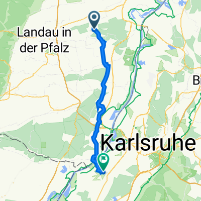 Hauptstraße 87, Zeiskam nach Wilhelm-Röntgen-Straße 15, Rheinstetten
- Distance
- 37.9 km
- Ascent
- 39 m
- Descent
- 53 m
- Location
- Zeiskam, Rhineland-Palatinate, Germany
Open it in the app