
T-649 Annual Bike HIke
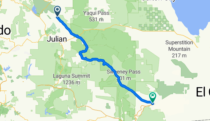
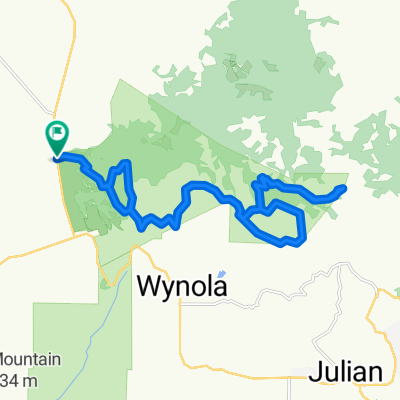
A cycling route starting in Julian, California, United States.
Overview
About this route
The members of BSA Troop 649 make this ride every January. Lunch the first day is at the Butterfield Stage Stop, and the first day's ride ends at Agua Caliente State Park. The next day, we ride to Ocotillo. Fun ride!!!
- -:--
- Duration
- 96.4 km
- Distance
- 343 m
- Ascent
- 1,300 m
- Descent
- ---
- Avg. speed
- ---
- Max. altitude
Route quality
Waytypes & surfaces along the route
Waytypes
Busy road
84.8 km
(88 %)
Quiet road
4.6 km
(5 %)
Surfaces
Paved
86.4 km
(90 %)
Unpaved
3.7 km
(4 %)
Asphalt
86.3 km
(90 %)
Ground
3.4 km
(3 %)
Route highlights
Points of interest along the route
Point of interest after 70.8 km
We gather here, and most put their bikes on the trailers and ride up the hill. Only the most dedicated (read "foolhardy") ride up the next hill!
Point of interest after 74.1 km
This is the toughest part of the ride. There's a steep up-hill climb, followed by a long up-hill climb! No Cubs are allowed to ride this portion, and most younger scouts are discouraged from riding it. The group gathers at the wash below the hill, and trucks and trailers are used to haul the riders and their bikes to a spot beyond the hill.
Point of interest after 78.8 km
This spot is where the riders re-mount their bikes and ride to the end.
Continue with Bikemap
Use, edit, or download this cycling route
You would like to ride T-649 Annual Bike HIke or customize it for your own trip? Here is what you can do with this Bikemap route:
Free features
- Save this route as favorite or in collections
- Copy & plan your own version of this route
- Split it into stages to create a multi-day tour
- Sync your route with Garmin or Wahoo
Premium features
Free trial for 3 days, or one-time payment. More about Bikemap Premium.
- Navigate this route on iOS & Android
- Export a GPX / KML file of this route
- Create your custom printout (try it for free)
- Download this route for offline navigation
Discover more Premium features.
Get Bikemap PremiumFrom our community
Other popular routes starting in Julian
 T-649 Annual Bike HIke
- Distance
- 96.4 km
- Ascent
- 343 m
- Descent
- 1,300 m
- Location
- Julian, California, United States
 329-> JULIAN - TEMACULA
- Distance
- 119 km
- Ascent
- 1,620 m
- Descent
- 2,593 m
- Location
- Julian, California, United States
 Santa Isabel
- Distance
- 72.2 km
- Ascent
- 992 m
- Descent
- 988 m
- Location
- Julian, California, United States
 Dudley's Bakery Sanfelipe 79
- Distance
- 73 km
- Ascent
- 1,020 m
- Descent
- 1,020 m
- Location
- Julian, California, United States
 4367 CA-78, Santa Ysabel to 12461–12499 Rancho Bernardo Rd, San Diego
- Distance
- 56.6 km
- Ascent
- 524 m
- Descent
- 1,485 m
- Location
- Julian, California, United States
 Santa Ysabel/Kanaka Flats
- Distance
- 27.2 km
- Ascent
- 855 m
- Descent
- 856 m
- Location
- Julian, California, United States
 Route to 22259–22933 CA-79, Santa Ysabel
- Distance
- 21.5 km
- Ascent
- 1,227 m
- Descent
- 1,410 m
- Location
- Julian, California, United States
 julian rad
- Distance
- 27.4 km
- Ascent
- 462 m
- Descent
- 462 m
- Location
- Julian, California, United States
Open it in the app